
What is recorded here
This probable trackway consists of a layer of small cobbles which is exposed in the face of an 8m wide peat-cutting located near St Brendan's Well (KE078-005----), in the Imlagh Basin, Valencia Island. It occurs .75m to 1m below the present peat surface, and appears to be a diagonal section of a stone trackway. In a nearby cutting, 9m to W, a cross-section of it, .6m wide and .35m thick, is exposed. A peat sample taken from the level of this feature yielded a radiocarbon date of 1720±80 BP (Mitchell 1989, 73).
The above description is derived from A. O'Sullivan and J. Sheehan (compilers), 'The Iveragh peninsula: an archaeological survey of South Kerry'. Cork University Press (1996), no. 24. In certain instances the entries have been revised and updated in the light of recent research.
Date of upload: 28 July 2013
The monument record does not grant public access. Check the route and ask the landowner before entering private land.
- What survives
- Recorded monument
Places near here
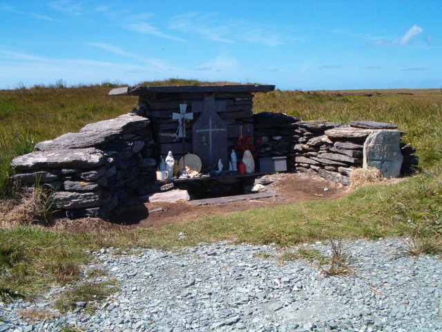 Tobar Olla BrenainnHoly well · 79 yd
 Hut site in BrayHut site · 454 yd
 Culloo RockViewpoint · 740 yd
 Telegraph Field Valentia IslandMemorial · 1.3 mi
 Cromwell's FortRuins · 1.4 mi
 Old Watch TowerRuins · 1.5 mi
 Bray HeadMountain / peak · 1.6 mi
 ValentiaIsland · 1.7 mi
 Horse IslandIslet · 1.9 mi
 Skellig Experience CentreMuseum · 2.0 mi
 Fogher CliffCliff · 2.1 mi
 GeokaunMountain / peak · 2.4 mi
Other information
Photo: Credit not shown in the picture search · Rights wording not checked; contact us if this picture should be removed