What is recorded here
A road bridge (Wth 7.5m; long axis SW-NE) spanning the Brown Flesk River. It is built of ashlar limestone with random rubble parapets and has three segmental arches (span c. 9m) with cut and dressed limestone voussoirs. There are low rounded cutwaters on both sides of the piers and a projecting string course across both faces of the bridge directly above the arches. Vertical stone coping on the parapets overhangs on both river faces. The parapet ends splay outwards and terminate in square piers. A plaque on the inner face of the NW parapet records the building of the bridge in 1831. (Castleisland District Archaeological Survey)
Compiled by: Elizabeth Byrne, Ursula Egan and Sheila Ronan, Archaeological Survey Unit, University College, Cork.
Date of upload: 31 January 2011
The monument record does not grant public access. Check the route and ask the landowner before entering private land.
- What survives
- Recorded monument
Places near here
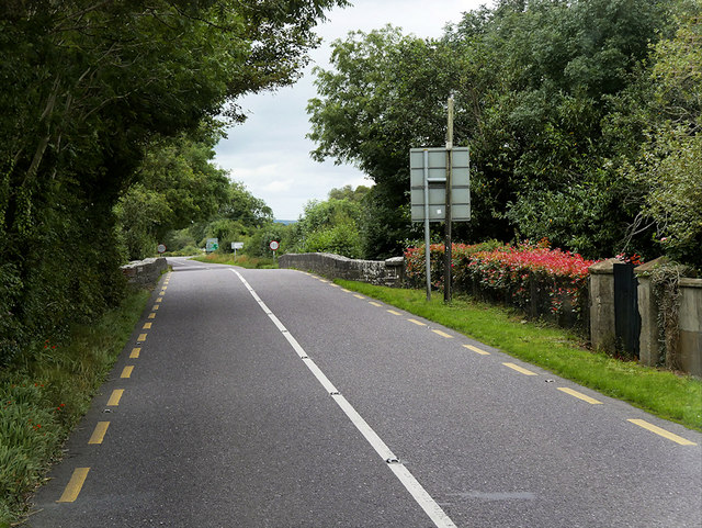 O'Connell Bridgebridge · 1 yd
 Enclosure in Crag (trughanacmy By., Currans Ed)Enclosure · 536 yd
 Enclosure in ArdcroneEnclosure · 1141 yd
 Farranfore Railway Stationrailway station · 1716 yd
 Site of Currans CastleCastle, unclassified · 1.3 mi
 CastleCastle, motte · 2.3 mi
 Crag CaveCave · 5.8 mi
 Ballygamboon Forest Recreation AreaWood · 6.1 mi
 Common AlderCommon Alder · 6.7 mi
 Aghadoe Early Medieval Ecclesiastical SiteHeritage attraction · 7.4 mi
 Famine MemorialMemorial · 8.1 mi
 Kerry 2nd Brigade of the Irish Republican ArmyMemorial · 8.4 mi