What is recorded here
Situated at the crest of the valley (Wth of top c. 20m; D c. 3m) of a small NE-SW stream on the NW side. A farm lane cut through the scarp leaving a section of the arc of a stone lined pit (Wth 0.8m; D c. 1m) surrounded by fire reddened clay. Above the stone-lined part the pit widened (Wth of top 2m) with 1m of fill over the stone-lined portion. The farm lane also cut the fire-pit (Wth 3-4m; D at least 1m) which has fire reddened clay sides and was c. 4m to the NE. There was no evidence of what might have been fired in the kiln.
The above description is derived from the published 'Archaeological Inventory of County Wexford' (Dublin: Stationery Office, 1996). In certain instances the entries have been revised and updated in the light of recent research.
Compiled by: Michael Moore
Date of upload/revision: 19 August, 2013
The monument record does not grant public access. Check the route and ask the landowner before entering private land.
- What survives
- Recorded monument
Places near here
 St. Cavans WellHoly well · 781 yd
 Kilcavan ChurchRuins · 925 yd
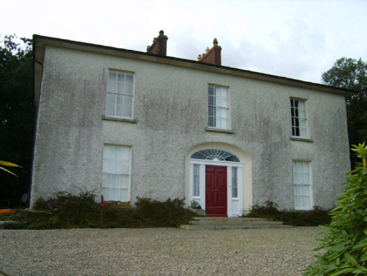 Balloughton Housefarm house · 1174 yd
 Castle (in ruins)Castle, tower house · 1367 yd
 Enclosure in CoolishalEnclosure · 1461 yd
 Danes Castle (in ruins)Castle, tower house · 1.3 mi
 Carrig-On-BannowVisitor information · 1.7 mi
 1798 MemorialMemorial · 1.7 mi
 Cullenstown StrandBeach / strand · 2.7 mi
 Coolcliffe HouseRuins · 3.1 mi
 Ballymadder PointHeadland · 3.3 mi
 Blackhall StrandBeach / strand · 3.4 mi
Other information
Photo: Credit not shown in the picture search · Rights wording not checked; contact us if this picture should be removed