What is recorded here
A bridge is mentioned in the Civil Survey of Co. Tipperary, 1654-6 (Simington 1934, vol. 2, 279). There is now a disused road bridge (Wth 5.1m; L 37.8m; wall T 0.45m) over the Nenagh River located beside the modern bridge where the approach road to Nenagh town has been straightened. The disused bridge consists of four arches of roughly cut voussoirs set on edge. The two central arches are semicircular with a lower segmental arch flanking either side. Two cutstone pointed breakwaters are visible on the upstream side with evidence that one of the central arches has been altered by the heightening of its arch. There is evidence of lime rendering and shuttering on the underside of the vault along with the widening of the bridge on the downstream side by 1.9m. The bridge was originally c. 3.8m in width. The parapet walls (wall T 0.4-0.45m; H 1m) were constructed with roughly coursed limestone rubble capped by crude limestone blocks which in places is capped by a modern concrete addition.
The above description is derived from 'The Archaeological Inventory of County Tipperary. Vol. 1 - North Tipperary' compiled by Jean Farrelly and Caimin O'Brien (Dublin: Stationery Office, 2002). In certain instances the entries have been revised and updated in the light of recent research.
Date of upload/revision: 22 September 2008
The monument record does not grant public access. Check the route and ask the landowner before entering private land.
- What survives
- Recorded monument
Places near here
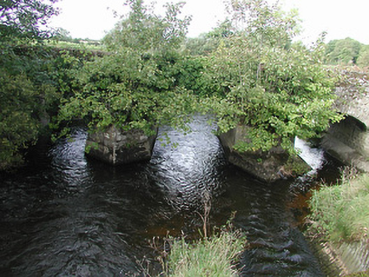 Nenagh Bridgebridge · 1 yd
 Wellington Househouse · 270 yd
 St. Johns WellHoly well · 368 yd
 Enclosure in Rathnaleen NorthEnclosure · 1047 yd
 Castle (in Ruins)Castle, unclassified · 1168 yd
 Old BarracksHeritage attraction · 1.1 mi
 Nenagh Heritage CentreMuseum · 1.2 mi
 Nenagh CastleCastle · 1.2 mi
 James Devaney MemorialMemorial · 2.7 mi
 Knigh HillMountain / peak · 3.0 mi
 Gibbet HillMountain / peak · 3.7 mi
 Blessed WellNature reserve · 4.6 mi