
What is recorded here
Mountjoy Castle stands in ruins above Lough Neagh, where Turlough Gruama O'Quinn seized the fort during the Irish Rebellion of 1641. The castle still belongs to public memory, preserving the moment when local force overturned an established position. Its broken walls mark a border between ownership and loss, inviting visitors to measure how quickly human control can collapse.
Mountjoy Castle is recorded as a ruins in County Tyrone. Its open map record supplies this location and any linked names or public references.
Places near here
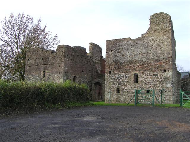 C17th CAMPAIGN FORT: MOUNTJOY CASTLE in Magheralamfield, MountjoyC17th CAMPAIGN FORT: MOUNTJOY CASTLE · 6 yd
 CROSS CARVED STONE (unlocated) in MagheralamfieldCROSS CARVED STONE (unlocated) · 172 yd
 Belville HouseHouse · 955 yd
 Drumard PlantationWood · 1.2 mi
 ENCLOSURE in AughamullanENCLOSURE · 1.3 mi
 Washing BayBay · 1.6 mi
 Drumcairne ForestWood · 1.9 mi
 St. Michael's ChurchChurch · 2.0 mi
 Clonoe ambushterrorist attack · 2.5 mi
 CrannogIslet · 2.9 mi
 Millennium MilepostVisitor information · 3.4 mi
 Coney IslandIslet · 3.7 mi
Other information
Photo: James1652 at English Wikipedia · Public domain