What is recorded here
The official Northern Ireland record identifies this as MOUND, possibly BARROW. Recorded period: PREHISTORIC; BRONZE AGE. The official map point was placed at the centre of the recorded archaeological site from the source map reference.
Bronze Age barrow; a burial monument reflecting early ceremonial and funerary practices in the region.
The monument record does not grant public access. Check the route and ask the landowner before entering private land.
- What survives
- Recorded monument
Places near here
 ENCLOSURE (O.S. memoir site, unlocated) in LisnagaltENCLOSURE (O.S. memoir site, unlocated) · 1.2 mi
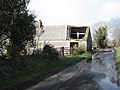 ENCLOSURE in Liswatty LowerENCLOSURE · 1.2 mi
 Castleroe WoodWood · 2.3 mi
 FORTIFIED HOUSE in ProspectFORTIFIED HOUSE · 3.0 mi
 Balnamore MillStore · 3.5 mi
 Railway StationRailway Station Structures · 3.5 mi
 Somerset ForestForest · 3.5 mi
 Ballymoney MuseumMuseum · 3.8 mi
 Millennium MilepostVisitor information · 3.9 mi
 CASTLE in Town Parks (ballymoney)CASTLE · 4.0 mi
 Quilley Picnic AreaPicnic place · 6.4 mi
 Old Bushmills DistilleryHeritage attraction · 6.8 mi