What is recorded here
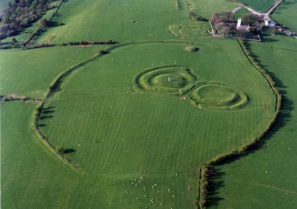
Castleboy Mound is a low earthen ring, twelve metres across and only forty centimetres high, holding a central depression four and a half metres wide. It sits inside a larger ringfort in County Meath, suggesting layered human use rather than a single sudden event. The shallow shape may have marked a boundary, stored something temporary, or simply been a place where people gathered before leaving no named trace behind.
The following description is derived from the published 'Archaeological Inventory of County Meath' (Dublin: Stationery Office, 1987). In certain instances the entries have been revised and updated in the light of recent research.
Date of upload/revision: 10 July 2007
Low earthen mound (diam. 12m, H 0.4m) with depression (diam. 4.5m) in centre. Within ringfort (ME031-033009-). (JRSAI 1978, 54, site H)
The monument record does not grant public access. Check the route and ask the landowner before entering private land.
- What survives
- Recorded monument
Places near here
 Teach ChormaicArchaeological place · 2 yd
 Ráith na RíoghArchaeological place · 63 yd
 Battle of Tara Hillbattle · 110 yd
 Battle of Tara (Ireland)Major battlefield · 111 yd
 St. Patricks ChurchChurch · 245 yd
 Hill of Tara Visitor Centrechurch/chapel · 268 yd
 Tara Open StudioGallery · 307 yd
 Saint Patrick'sMemorial · 310 yd
 Hill of TaraVisitor information · 426 yd
 CrockaphobbieWood · 1.2 mi
 CastleCastle, tower house · 1.3 mi
 Clusker Wood NorthWood · 1.3 mi