What is recorded here
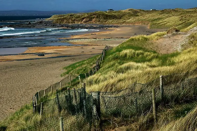
Thirty metres inland from the North Atlantic, a vanished kitchen still breathes through the dunes. Storms stripped most of the hill in winter 2019, leaving only a knife-thin ribbon of limpet shells beneath marram grass. Someone sat there, ate, struck stone against stone, and discarded the remains; the sea took the story back before it could be remembered.
Exposed in section in sand dunes N of Fanore beach and c. 30m E of normal high tide. In 2019 a midden (total L 8.5m) with a thin layer of limpet shells was reported by Carolyn Howle Outlaw. A cluster of 39 intact shells were reported with others having fallen to the shore. Further limpet shells and 3 fire-cracked stones were noted in an erosional slump to the W of the midden. A stone cobble/possible hammer stone was recovered from the section face directly below the shell layer in 2019 (pers. comm. Liam McNamara) and was transferred to the National Museum in 2021. Storms during winter 2019/2020 severely eroded a large portion of N and W extent of the midden (pers. comm. Liam McNamara). On inspection in 2021 the visible remains were found to be scant, consisting of a thin layer (L 0.6m; D 0.05m) of limpet shells exposed in section in the eroding W-facing side of a low marram grass-covered sandy rise (L c. 10m N−S; c. 3m E−W; H c. 1m), probably the last remnant of a larger sand hill. The midden underlies a layer (D 0.35m) of sand topped with marram grass, and overlies sand. Two shell middens (CL001-019---- and CL001-021----) lie to the S of Fanore beach and were dated to the Mesolithic/Early Neolithic.
The following images have been uploaded:
CL001-023----_01.jpg Exposed section from NW (photo: Carolyn Howle Outlaw)
CL001-023----_02.jpg Firecracked stone (photo: Carolyn Howle Outlaw)
CL001-023----_03.jpg Midden 2019 from W (photo: Carolyn Howle Outlaw)
CL001-023----_04.jpg Midden 2021 from W
CL001-023----_05.jpg Close view of limpet shells 2021
CL001-023----_06.jpg Hammerstone found 2019
CL001-023----_07.jpg Hammerstone found 2019
Revised by: Mary Tunney
Date of revision: 1 March 2023
The monument record does not grant public access. Check the route and ask the landowner before entering private land.
- What survives
- Recorded monument
Places near here
 Fanore BeachBeach / strand · 568 yd
 Fanore Bridgebridge · 857 yd
 garda station/constabulary barracksgarda station/constabulary barracks · 963 yd
 CaherdoonteigushaFairy fort / stone ringfort · 1391 yd
 Enclosure in Fanore MoreEnclosure · 1680 yd
 Faunarooska Castle (in ruins)Castle, tower house · 2.2 mi
 Black HeadHeadland · 2.3 mi
 FaunarooskaCave · 2.7 mi
 PollbailinyCave · 2.8 mi
 Slieve ElvaMountain / peak · 2.9 mi
 Gleninagh CastleCastle · 3.6 mi
 CappanawallaMountain / peak · 3.8 mi