What is recorded here
On sloping ground, immediately to the W of Macroom. This Man-made underground passage was discovered in 2001 following the collapse of the roof of a chamber during the construction of a housing development. It consists of six roughly oval earth-cut chambers with flat floors and domed roofs. The three most easterly chambers (chambers 4, 5 and 6) are located slightly to the S of the three most westerly chambers. Access to the Man-made underground passage was gained through the collapsed section of the roof of chamber 3 that was 1.4m below present ground level. Chamber 1 (L 5.6m; Wth 1.7-3m; H 1.4m) is the largest of the six chambers. There are two blocked-up construction shafts in the N side. Two long parallel creepways in the E side lead to chamber 2. Chamber 2 (L 4.2m; Wth 1.5m; H 1.3m) is the narrowest chamber and has a blocked-up construction shaft in its N end. A creepway in its E side leads into chamber 3. Chamber 3 (L 3.3m; Wth 1.25m; max. H 1.2m) is the shortest chamber and has a blocked-up construction shaft in its N end. A creepway in the S end of the E side gives access to chamber 4. Chamber 4 (L 4.11m; Wth 2.06m; H 1.4m) has a blocked-up construction shaft in its S end. A creepway in the E side of chamber 4 gives access to Chamber 5. Chamber 5 (L 4.45m; Wth 1.1-2.1m; H 1.8m) has a blocked-up construction shaft in its SE end. A creepway in the E side of chamber 5 gives access to chamber 6. Chamber 6 (L 4.62m; Wth 2.2m; H 1.8m) has a blocked-up construction shaft in its S side. Following investigation, the collapsed opening was sealed with cast in situ reinforced concrete slabs. (McCarthy 2001)
The above description is derived from 'The Archaeological Inventory of County Cork. Volume 5' (Dublin: Stationery Office, 2009).
Date of upload: 22 December 2009
The monument record does not grant public access. Check the route and ask the landowner before entering private land.
- What survives
- Recorded monument
Places near here
 Corn MillMill, corn · 209 yd
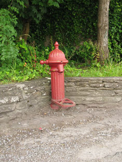 water pumpwater pump · 271 yd
 Burial Gd (Disused)Burial ground · 484 yd
 Macroom WalksVisitor information · 541 yd
 Macroom Castle (in Ruins)Castle, tower house · 690 yd
 Battle of Macroombattle · 930 yd
 Fulacht fia in Gurteenroe (muskerry West By.)Fulacht fia · 1285 yd
 Neill's WoodWood · 1.2 mi
 Sessile OakSessile Oak · 1.5 mi
 Dundareirke Castle (in Ruins)Castle, tower house · 2.5 mi
 Clonavrick CliffCliff · 2.9 mi
 BurrenMountain / peak · 4.2 mi