What is recorded here
Within the now destroyed N half of a conjoined ringfort (GA029-080----). A plan of this Man-made underground passage drawn up by Costello (1902b. 111) indicates that it consisted of two chambers connected by a creep and was roughly L-shaped in plan. Costello (1903, 4) noted that it was much-ruined, 'only one of the large roofing flags is left in the first chamber, but about half of the second chamber is still roofed'. No trace of Costello's 'first' chamber survives and only half of the 'second'. This chamber initially runs WSW-ENE and consists of a hollow (L 7.8m) with traces of drystone-walling along NW wall. At WSW end, it curves gently and continues on an E-W axis. Here the chamber (L 6.5m, Wth 1.9m) survives intact.
The above description is derived from the published 'Archaeological Inventory of County Galway Vol. II - North Galway'. Compiled by Olive Alcock, Kathy de hÓra and Paul Gosling (Dublin: Stationery Office, 1999).
Date of upload: 05 August 2010
This remains an important historical record, but the official description says the monument is no longer visible or has been destroyed. The monument record does not grant public access. Check the route and ask the landowner before entering private land.
- What survives
- No visible remains or recorded as destroyed
Places near here
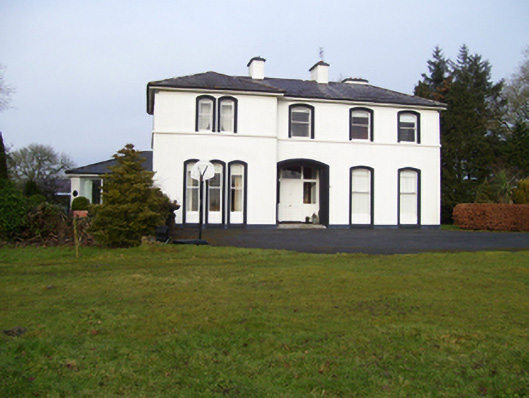 Gardenfield Househouse · 165 yd
 Cross in CarrownagarryCross · 797 yd
 Enclosure in GardenfieldEnclosure · 894 yd
 water pumpwater pump · 1138 yd
 European ashEuropean ash · 1546 yd
 CastleCastle, unclassified · 2.0 mi
 Mass RockNamed rock · 2.8 mi
 Fartamore Castle in ruinsCastle, tower house · 3.0 mi
 KnockmaaWood · 5.7 mi
 Kilcoona Round TowerHeritage attraction · 9.5 mi
 Ballinduff BayBay · 12 mi
 Walsh's IslandIslet · 13 mi