What is recorded here
Underground tunnels in a cliff-edge fort in county Limerick may have let people move through stone when storms closed the land above. They are not visible now, but maps and old descriptions keep them company beside the standing stone.
In pasture, immediately N of townland boundary with Clovers. Possible Man-made underground passage in the interior of a cliff-edge fort (LI056-015001-) with a standing stone (LI056-015002-) to immediate W. In 1931 the monument was described as; ‘two moats or lisses with Man-made underground passages’ (O’Shaughnessy and Carroll 1931, 69-70). Annotated ‘Man-made underground passage’ on Cassini ed. OSi 6-inch map, not depicted on 1840 ed. OSi 6-inch map or 1897 ed. OSi 25-inch map. No surface remains of levelled monument on Digital Globe orthoimage taken between 2011-2013. Faint trace of D-shaped cropmark of cliff-edge fort on Google Earth orthoimage dated 28/06/2018 but no trace of Man-made underground passage visible.
See attached Google Earth orthoimage
Compiled by: Caimin O’Brien
Date of upload: 2 December 2021
The monument record does not grant public access. Check the route and ask the landowner before entering private land.
- What survives
- Recorded monument
Places near here
 Cliff-edge fort in Ballinlyna LowerCliff-edge fort · 1 yd
 Man-made underground passageMan-made underground passage · 277 yd
 Tuck MillWater mill, unclassified · 1277 yd
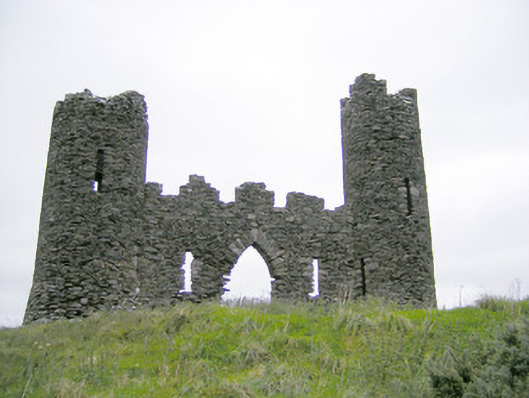 Castle Oliverfolly · 1615 yd
 Treada Na Ríogh (The Moat), hachuredCastle, motte · 1.0 mi
 Ballyhoura tourist informationVisitor information · 1.1 mi
 Castle (in ruins)Castle, tower house · 1.2 mi
 Gooseberry HillMountain / peak · 1.2 mi
 Keale MountainMountain / peak · 1.3 mi
 Palatine's RockNamed rock · 1.8 mi
 Ballyhoura WayWalking route · 1.9 mi
 ToberpatrickSpring · 2.2 mi