What is recorded here
Macroom emerged beside the Sullane River as a market town under Lord Muskry, its castle standing as a strong pile while weekly trades circulated through linear streets. Robert Hedges Eyre later transformed the castle into a mansion and rebuilt the market house, joining distilleries, woollen mills and flour works in the town's growth. The place still carries that practical rhythm, where salt, butter and cloth once moved outward from a small river crossing.
A small settlement is marked on the Down Survey (1655-6) Barony map on the E side of the Sullane River and in the vicinity of the present day town of Macroom (Maigh Chromtha). The terrier of the Down Survey Map of Muskerry Barony recorded that, 'The places of note are the towne and castle of Macrumpre [Macroom] being a market towne, one of the places of residence of the Lord Muskry, the castle being a faire and strong pile with a bane [bawn], divers houses a fort and severall offices' (Hib. Reg.). The historic town of Croom is depicted as a cluster of dwellings arranged in a linear fashion to the E of Macroom Castle (CO071-049----) and Church (CO071-050002-) on the 1655-9 Down Survey map of Macroom parish (NLI, Ms. 712-3). The terrier of the Down Survey parish map recorded in 'this Parish is the Castle and Towne of Mackrompe [Macroom] consisting of severall good Towne Houses and large cabins and in the same is a Marckett kept once every weeke' (ibid.). The present Main Street follows the line of the linear settlement depicted on the Down Survey parish map.
According to Zajac et al. (1995, 67) 'a settlement may have existed in Macroom during the 13th century when a castle was built here adjacent to a fording point on the Sullane river. Until the mid-19th century the town was the joint property of the Earl of Bandon and Robert Hedges Eyre. It became the sole property of the latter who was responsible for several improvements in the town including the rebuilding of the present market house and alterations to the castle transforming it into a modern mansion. Among the industries established in Macroom in the 18th century were a distillery and a woollen mill. Rock salt was also brought from England via Cork and distributed from the town for use in salting butter for export. In the 19th century flour mills and tanyards were established.'
See attached Down Survey map of Macroom parish
The above description is derived from 'The Archaeological Inventory of County Cork. Volume 5' (Dublin: Stationery Office, 2009).
Revised by: Caimin O'Brien
Date of revised upload: 14 August 2021
The monument record does not grant public access. Check the route and ask the landowner before entering private land.
- What survives
- Recorded monument
Places near here
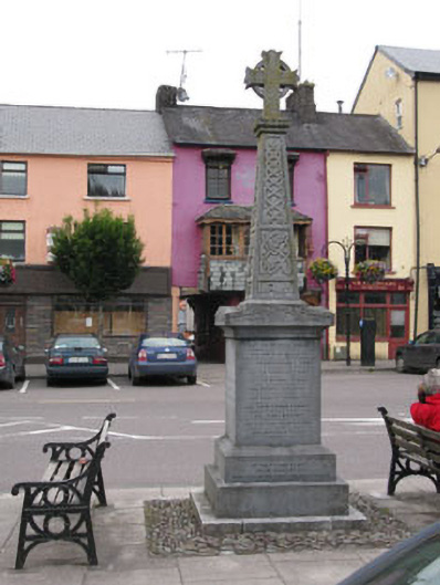 monumentmonument · 8 yd
 Macroom Market Housemarket house · 24 yd
 Macroom Castle (in Ruins)Castle, tower house · 139 yd
 Battle of Macroombattle · 233 yd
 Macroom WalksVisitor information · 281 yd
 Burial Gd (Disused)Burial ground · 752 yd
 Fulacht fia in Gurteenroe (muskerry West By.)Fulacht fia · 1717 yd
 Sessile OakSessile Oak · 1.3 mi
 Ummera WoodWood · 1.5 mi
 Mashanaglass Castle (in Ruins)Castle, tower house · 2.3 mi
 Clonavrick CliffCliff · 3.2 mi
 BurrenMountain / peak · 4.4 mi