
What is recorded here
Five-arched bridge, located off the Dublin-Belfast road north of Swords village where it crosses the Broadmeadow river. It is marked on the Down Survey (1655-6) map. Built of mortared limestone masonry. The bridge has three abutting sections, the middle section has slightly pointed arches with wattle marks. The upriver cutwaters are triangular with semi-pyramidal cutwater cappings. It has been dated to the period 1450-1550 (O'Keeffe, P. and Simington, T. 1991, 186-188).
Ground penetrating radar and test –excavation (Licence no. 09E0464) undertaken in advance of the proposed Metro North identified that much of the medieval fabric has survived within the Lissenhall Bridge structure. A wall extends on the eastern side between Lissenhall and Balheary Bridges and an arch/culvert predating the existing visible culvert on the western side of the bridge exists beneath the road. This is suggestive of a precursor or early phase of building, possibly indicating an early road prior to the redevelopment or widening of the road in the late 17th/early 18th century (Channing 2009, 21).
Compiled by: Geraldine Stout
Updated by: Christine Baker
Date of upload: 09 January 2015
The monument record does not grant public access. Check the route and ask the landowner before entering private land.
- What survives
- Recorded monument
Places near here
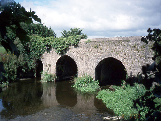 Lissen Hall Bridgebridge · 1 ydBalheary Bridgebridge · 116 yd
 Enclosure in Lissenhall GreatEnclosure · 505 yd
 Enclosure in Lissenhall LittleEnclosure · 546 yd
 Fingal Tourism OfficeVisitor information · 1470 yd
 Swords CastleCastle · 1473 yd
 Tower (in ruins), Castle and ChapelCastle, Anglo-Norman masonry castle · 1474 yd
 Swords Round TowerHeritage attraction · 1.1 mi
 Graveyard (Disused)Church · 1.1 mi
 St Colmcilles WellVisitor information · 1.1 mi
 St Cronans WellSpring · 1.4 mi
 Kim Archibold MemorialMemorial · 1.5 mi
Other information
Photo: Gallftree008 · CC BY-SA 4.0