What is recorded here
Lisgriffin Castle is a ruined fortified house in County Cork, Ireland, where a tall west gable still rises above pasture to watch the Bregoge River valley. Built for the Barrys in the early 17th century, it kept machicolations along its eaves and a gun loop near the north-west corner, suggesting residence and defence shared one narrow stone body. Much has fallen away, but the remaining walls still mark the shape of a home that faced the water and resisted the dark.
In pasture, on level platform, overlooking Bregoge River valley to E. Only west gable wall (L 9.9m), and short returns of N wall (L 2.8m) and S wall (L 2.7m) now stand. Gable stands to three storeys with attic, over basement. All standing walls have continuous machicolations at eaves level. Edge coping of gable almost intact; chimney stack survives on gable apex. Some stones protruding from exterior N wall suggest bawn wall was once attached here. Central windows in W wall at ground-, 1st- and 2nd-floor levels; all embrasures splayed and appear to have been lintelled, but lintels now missing; ground-floor ope badly damaged; window on 1st floor has rectangular light divided by two mullions, N one missing, covered by hood moulding; similar window on 2nd floor but with one mullion, now missing. Splayed W ingoings of window embrasures, on surviving sections of N and S walls, visible at ground-, 1st- and 2nd-floor levels. Central fireplace in W wall on attic floor, lintel missing; small rectangular opes on each side probably attic windows.
Ground-floor N wall pierced by tapering gun loop, close to NW corner. All floors formerly wooden; projecting masonry plinth (H 1.2m) at ground level, intact only in SW corner, would have carried basement roof; remaining floors set in joist sockets in N and S walls. Photograph of 1865 (Grove White 1905-25, vol. 4, opp. 32) shows structure more complete, with intact windows in S wall at 1st- and 2nd-floor levels identical to those in W wall, and chimney stacks rising from N and S walls.
Castle of the Barrys, reputedly built in early 17th century (ibid., 31), a date consistent with surviving remains. Down Survey (1655-6) (1655-6) barony map shows house and tower here; unsure which portrays this structure.
The above description is derived from the published 'Archaeological Inventory of County Cork. Volume 4: North Cork' (Dublin: Stationery Office, 2000). In certain instances the entries have been revised and updated in the light of recent research.
Date of upload/revision: 14 January 2009
The monument record does not grant public access. Check the route and ask the landowner before entering private land.
- What survives
- Recorded monument
Places near here
 Lisgriffin CastleCastle · 5 yd
 Ladys WellHoly well · 173 yd
 Lady's WellSpring · 187 yd
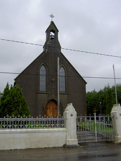 Saint Mary's Churchchurch/chapel · 221 yd
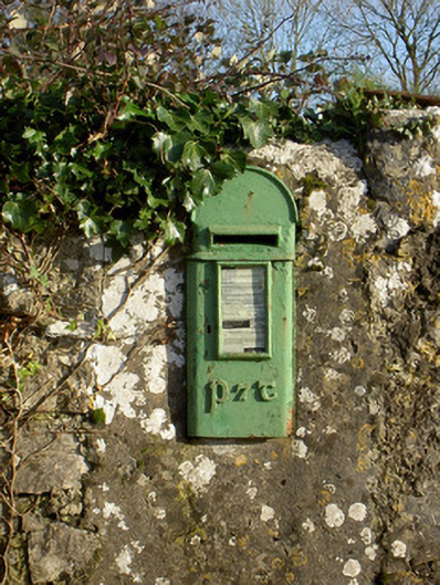 post boxpost box · 446 yd
 Enclosure in ArdapriorEnclosure · 1501 yd
 CarrigadoonCastle, unclassified · 1.6 mi
 Churchtown TrailsVisitor information · 1.9 mi
 Battle of LiscarrollMajor battlefield · 3.2 mi
 Charles BunworthMemorial · 3.4 mi
 Graveyard in Ballygiblin (duhallow By.)Graveyard · 4.0 mi
 European YewEuropean Yew · 5.2 mi