What is recorded here
Knockgrannie is a circular burial mound on a sandy rise above the northern beach, marked by slab-lined graves and two small limestone pillars on a kerbed platform. The sea shifted sands in 1885 to reveal the site, prompting human hands to expose what water had hidden. The dead remained inside the mound while the living argued over whether they had disturbed or rescued the dead.
On a sandy rise above the beach close to N shore of the island. This Nat. Mon. is a circular mound revetted by a drystone wall (D 21m, H >1.5m) and it is known locally as Cnoc Raithní (Robinson 1980). Traces of slab-lined graves protrude above S half of the flat top of the mound. The N half is occupied by a small rectangular kerbed platform (H 0.9m) surmounted by two small limestone pillars. Discovered in 1885 by shifting of sands, 'excavated' and 'restored' by the Board of Works (Clark 1969, xi). A cordoned urn, a smaller vessel, a bronze artifact and bone were recovered from a circular cist (D c. 1.5m, H c. 1.2m) in the body of the cairn (Murphy 1886). Other graves and pottery were also found but there is confusion as to their location and context. (Westropp 1895, 272; Daly 1975, 76-7; Waddell 1975, 17; Kavanagh 1976, 365, where wrongly provenanced)
The above description is derived from the published 'Archaeological Inventory of County Galway Vol. I - West Galway'. Compiled by Paul Gosling (Dublin: Stationery Office, 1993). In certain instances the entries have been revised and updated in the light of recent research.
Updated by: Olive Alcock
Date of revised upload: 20 January 2016
This monument was taken into Ownership under the National Monuments Acts 1930 to 2014 - National Monument 41.
Neolithic passage tomb; dates to the early to middle Neolithic period (c. 3700–3000 BCE). Its construction and location reflect the significance of coastal landscapes in early Irish funerary and ritual practices.
The monument record does not grant public access. Check the route and ask the landowner before entering private land.
- What survives
- Recorded monument
Places near here
 Cnoc RaithníHeritage attraction · 2 yd
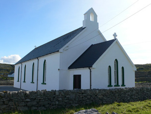 Séipéal Naomh Caomhánchurch/chapel · 286 yd
 Lár na TráBeach / strand · 298 yd
 coastguard stationcoastguard station · 300 yd
 Holy well in Inis OírrHoly well · 344 yd
 IndicatedFairy fort / stone ringfort · 451 yd
 Cill GhobnaitHeritage attraction · 451 yd
 Caisleán Uí BhriainCastle · 466 yd
 Port na CilleBeach / strand · 736 yd
 Inis OírrIsland · 1055 yd
 Gob na CoraHeadland · 1.1 mi
 FárdorasHeadland · 1.4 mi