
What is recorded here
Killaghtee Old Church Graveyard holds crosses and forgotten names beside good pasture, while the seashore waits a short distance to the southwest. The church itself survived repair and change until 1826, but the graveyard kept its own quieter continuity. People may have walked past buried markers, prayed at the cross-inscribed slab, or simply grazed animals above old grief. What is missing is not emptiness; it is the part of life that stopped speaking its own name.
Killaghtee Old Church (DG098-013001-): Described in the Civil Survey of 1654-6 as in reparation, the church at Killaghtee continued in use until 1826 when the present Church of Ireland parish church was built (Leslie 1940, 86-7). Adjacent to the church is a graveyard (DG098-013004-). To the SW of the church and inside the graveyard is a cross-inscribed slab (DG098-013002-). Conaghan (1977, 57) reported 'two damaged bullaun stones (DG098-013003-) at the church' but these were not located in the course of the survey. The site is located on good pasture land with the seashore a short distance to the SW.
The above description was derived from the 'Archaeological Survey of County Donegal. A description of the field antiquities of the County from the Mesolithic Period to the 17th century.' Compiled by: Brian Lacey with Eamon Cody, Claire Cotter, Judy Cuppage, Noel Dunne, Vincent Hurley, Celie O'Rahilly, Paul Walsh and Seán Ó Nualláin (Lifford: Donegal County Council, 1983). In certain instances the entries have been revised and updated.
Date of upload/ revision: 20 May 2010
The monument record does not grant public access. Check the route and ask the landowner before entering private land.
- What survives
- Recorded monument
Places near here
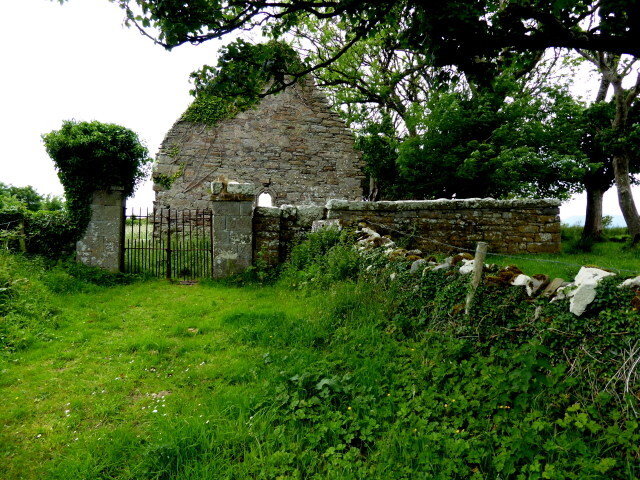 Killaghtee Old ChurchChurch · 17 yd
 Killaghtee Church (ruins)Ruins · 19 yd
 Killaghtee Stone RingfortFairy fort / stone ringfort · 623 yd
 Darney Raised Fairy FortFairy fort / earthen ringfort · 997 yd
 Bawn in Rahan NearBawn · 999 yd
 Wych ElmWych Elm · 1339 yd
 GinkgoGinkgo · 1434 yd
 Rashenny PointHeadland · 2.3 mi
 Carntullagh HeadHeadland · 2.4 mi
 Cat CastleCastle, tower house · 2.5 mi
 Rotten IslandIslet · 2.5 mi
 Rabley HillMountain / peak · 3.8 mi
Other information
Photo: Kenneth Allen · CC BY-SA 2.0