
What is recorded here
Marked Cullenagh Abbey on the 1841 edition of the OS 6-inch map. Remains of a nave and chancel church (L c. 18.7m, Wth c. 9.4m; wall T c. 0.9m) built of rubble limestone roughly coursed. Doorway in E end of N wall, and evidence of blocked-up opes in N and S walls. No other visible features.
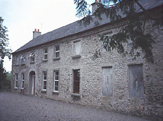
Kilfailan church is not indicated on the first edition of the OS 6-inch map but is indicated as being in ruins on the last edition of the OS 6-inch map. Local tradition that the cattle shed to the rear of a 19th century farmhouse and seventeenth century fortified house (LA018-039) are the remains of Kilfailan Church. The upstanding cattle shed is not of medieval date and its walls only measure 0.6m in maximum thickness. There are brick arches and slit windows and the wall construction is all indicative of the 18th/19th century in date. As no church is marked in this area on the first edition of the OS 6-inch map and the building appears to post-date the seventeenth century. This building may have been incorrectly identified as a church via the local tradition or this tradition refers to an 18th century chapel or penal chapel that was abandoned and converted into a cattle shed in the 19th century.
The above description is derived from the published 'Archaeological Inventory of County Laois' (Dublin Stationery Office, 1995) compiled by P. David Sweetman, Olive Alcock and Bernie Moran. In certain instances the entries have been revised and updated in the light of recent research.
Date of upload: 17 December 2007
The monument record does not grant public access. Check the route and ask the landowner before entering private land.
- What survives
- Recorded monument
Places near here
 Bawn in Cullenagh (cullenagh By.)Bawn · 97 yd
 Enclosure in Cullenagh (cullenagh By.)Enclosure · 1010 yd
 Yellow Househouse · 1479 yd
 Enclosure in CremorganEnclosure · 1.0 mi
 Church (in Ruins)Church · 1.1 mi
 CastleCastle, motte and bailey · 1.6 mi
 Rock of CashelMountain / peak · 1.9 mi
 Timahoe Church and Round TowerVisitor information · 1.9 mi
 Rock of Dunamase InformationVisitor information · 4.7 mi
 Rock of DunamaseCastle · 4.7 mi
 Burial Ridge of MaryboroughMemorial · 5.1 mi
 European BeechEuropean Beech · 5.1 mi
Other information
Photo: Credit not shown in the picture search · Rights wording not checked; contact us if this picture should be removed