What is recorded here
Enclosing a hilltop with a steep drop to the SW and a more gradual fall of slope to the NE before the ground levels out within the NE quadrant. Ringfort (TS075-040----) located c. 50m to the NE. The summit of the hill runs NW-SE roughly through the centre of the monument. Large steep-sided hillock (diam. 170m N-S and E-W) enclosed by internal fosse (Wth 3.4m) and large substantial outer bank (Wth crest 6-10.5m; base 8.7-14m; int. H 2.3-2.78m; ext. H 1.17-3.6m). A modern stone wall has been built on portion of the bank in the NE quadrant from N to NE. The summit has been partially quarried into resulting in an irregular hollow N of centre. There is a cattle gap through the bank in the WSW. There is a lot of stone evident in the grass-covered bank. The bank in the S quadrant has been quarried into and the bank in the SE is slightly denuded. From E-SE the bank has been levelled with only low traces surviving. In the NW sector the bank kinks out to form a possible structure (dims. 10.3m NE-SW; 12m NW-SE) or may be result of quarrying. There is a possible entrance (Wth 2m) to the enclosure immediately W of this structure. The OS Letters refer to some interference with the bank at the NE and S sides where 'lately part of it was pared off outwardly...for a byroad that runs here now' (O'Flanagan 1930, vol. 2, 125).
Compiled by: Jean Farrelly
Date of upload: 7 April 2014
The monument record does not grant public access. Check the route and ask the landowner before entering private land.
- What survives
- Recorded monument
Places near here
 Kedrah FortArchaeological place · 15 yd
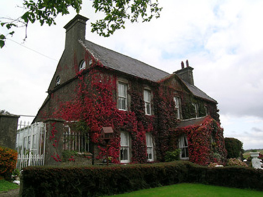 Keylong Househouse · 534 yd
 Bridge in Cloghabreedy,kedrahBridge · 777 yd
 Bawn in KedrahBawn · 886 yd
 Bawn in CloghabreedyBawn · 887 yd
 IndicatedFairy fort / earthen ringfort · 1.2 mi
 Caher AbbeyHeritage attraction · 1.6 mi
 Siege of Cahir Castlesiege · 1.8 miCahir CastleHeritage attraction · 1.9 mi
 European YewEuropean Yew · 2.9 mi
 Cottagehill WoodForest · 3.0 mi
 Slieveanard NE TopMountain / peak · 3.9 mi