What is recorded here
Situated on a knoll on a gentle SE-facing slope, with a S-N section of the Delvin River c. 50m to the E. The parish church is of Stamullin (ME034-001----), which survives almost complete, is situated within a D-shaped graveyard (dims c. 56m E-W; c. 51m N-S) defined by masonry walls, with straight sides at E and S. The attached chantry chapel which is kept locked has an effigy of a cadaver (ME034-001004-) and a mid 16th-century double effigy tomb (ME034-001005-). Archaeological testing (95E0143) by R. Swan c. 40m SW of the graveyard produced evidence of a fosse which could be part of an ecclesiastical enclosure (ME034-001002-) (excavations.ie 1995:236). However, archaeological testing (05E0277) by A. O’Connell c. 50-120m SE-S of the graveyard produced no related material (excavations.ie 2005:1245). Further testing (06E0914) by M. Seaver c. 130m NE of the graveyard at the nearest point had a similar result (excavations.ie 2006:1642).
Compiled by: Michael Moore
Date of upload: 11 February, 2015
Amended: 29 January 2021
A portal dolmen dating to the Neolithic period; its location near the Delvin River and proximity to the parish church suggest it may have had ritual or communal significance in the prehistoric landscape.
The monument record does not grant public access. Check the route and ask the landowner before entering private land.
- What survives
- Recorded monument
Places near here
 Ecclesiastical enclosure in StamullinEcclesiastical enclosure · 71 yd
 QuarryQuarry · 624 yd
 Man-made underground passage in Gormanstown DemesneMan-made underground passage · 965 yd
 Ballshill PlantingForest · 1542 yd
 SycamoreSycamore · 1.1 mi
 Gormanston CastleCastle · 1.1 mi
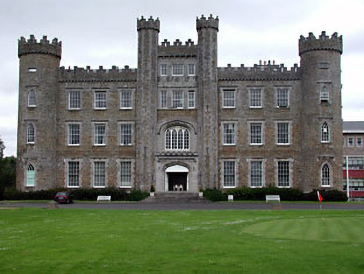 Gormanston Collegecastle/fortified house · 1.1 mi
 MoatCastle, motte · 2.1 mi
 Ben HeadCliff · 2.4 mi
 Clonard SpringSpring · 2.5 mi
 Seamus Ennis Cultural CentreMemorial · 3.2 mi
 Bun-na-CnoicMemorial · 3.4 mi