
What is recorded here
Depicted on the 1838 ed. OSi 6-inch map as a polygonal-shaped woodland plantation on the landscaped demesne lands of Kilranelagh House located 300m to S. Not depicted as an antiquity on any ed. OSi historic maps. Present remains consists of a raised sub-oval or polygonal-shaped area (dims. c. 60m N-S x 60m E-W) enclosed by a tree-covered earth and stone bank with external facing visible in places, fosse and external bank with faint traces of a possible outer fosse. A narrow break in the bank with a corresponding brake in slope to NE may represent the remains of an entrance. A post-1700 grotto has been built across the top of the outer fosse at S. Possible remains of a ringfort that was re-used as a landscape feature or tree-ring associated with nearby Kilranelagh House. Visible as a tree-lined enclosure on Google Earth orthoimage taken 20/05/2020.
See attached Google Earth orthoimages and ground photographs supplied by Robert Hanbidge
Compiled by: Caimin O'Brien based on details provided by Robert Hanbidge
Date of upload: 25 Febuary 2021
A local fairy fort (ringfort/rath); wider significance not recorded.
The monument record does not grant public access. Check the route and ask the landowner before entering private land.
- What survives
- Recorded monument
Places near here
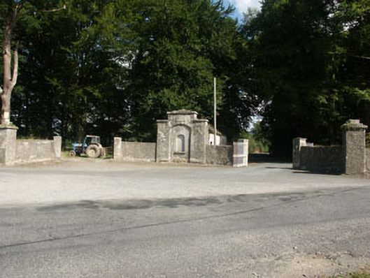 Kilranelagh Housegate lodge · 418 yd
 EnclosureEnclosure, large enclosure · 543 yd
 St. Bridgets Head StoneRitual site, holy/saint's stone · 778 yd
 Saint Brigit's Mass StoneNamed rock · 785 yd
 Saint Brigit's ChairNamed rock · 1073 yd
 Sam McAllistair GraveMemorial · 1212 yd
 Church (in Ruins), Grave Yard (Disused)Church · 1.1 mi
 MoatamoyCastle, motte · 1.1 mi
 Castle in ruinsCastle, unclassified · 1.4 mi
 Keadeen MountainMountain / peak · 2.5 mi
 Dwyer McAllister CottageMuseum · 3.3 mi
 English hollyEnglish holly · 3.3 mi
Other information
Photo: Credit not shown in the picture search · Rights wording not checked; contact us if this picture should be removed