What is recorded here
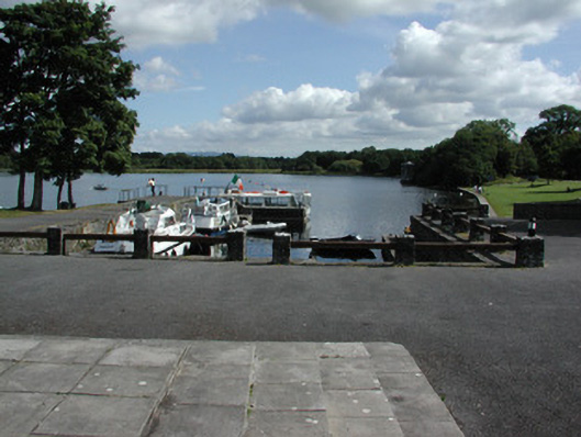
Indicated is a slipway in Rockingham Demesne (boyle By., Rockingham.ed), County Roscommon, Ireland. It occupies the NW end of a promontory on the SE shore of Lough Key, about 270m SE of the castle of the Rock and at the closest shore point to it. Large flat slabs form a paved area where the NE side survives complete, while the rest may extend further inland.
Situated at the NW end of a promontory on the SE shore of Lough Key, c. 270m SE of the castle of the Rock (RO006-046----) and at the closest point of the shore to it. A paved area (dims. 14m NW-SE; 1m NE-SW at NW to 3.4m NE-SW at SE) composed of large slabs (dims. c. 0.2-0.3m x c. 1m) laid flat, but only the NE side survives complete. It may extend further inland (L c. 20m). Identified and recorded by S. Moore in an EIS project during 2005. (O'Conor et al. 2010, 23)
Compiled by: Michael Moore
Date of upload: 24 August 2010
The monument record does not grant public access. Check the route and ask the landowner before entering private land.
- What survives
- Recorded monument
Places near here
 Castle IslandIslet · 322 yd
 Enclosure in Rockingham Demesne (boyle By., Rockingham.ed)Enclosure · 347 yd
 Rockingham Housequay/wharf · 438 yd
 Green IslandIslet · 525 yd
 Longford HillMountain / peak · 681 yd
 Horse-chestnutHorse-chestnut · 685 yd
 Western RedcedarWestern Redcedar · 811 yd
 Embanked enclosureFairy fort / earthen ringfort · 1000 yd
 Rockingham DemesneRuins · 1262 yd
 Lough Key Forest ParkWood · 1490 yd
 Erris BayBay · 1.3 mi
 Boyle AbbeyHeritage attraction · 2.9 mi