
What is recorded here
Indicated is a fairy fort in County Cavan, Ireland. It contains a raised circular area twenty-six point four metres across, enclosed by a low earthen bank and later stone wall. A modern laneway touches its outer edge, while a narrow eastern gap may mark the true entrance. The place still keeps its shape, waiting for someone to remember why it was built.
Raised circular area (int. diam. 26.4m) enclosed by a low earthen bank, largely replaced by a low stone wall particularly in the S half of the site, and slight traces of a fosse. A modern laneway encircles the external foot of the wall from SSE-S-SW. Break in perimeter (Wth 2.25m) at E may represent original entrance.
The above description is derived from the published 'Archaeological Inventory of County Cavan' (Dublin: Stationery Office, 1995). In certain instances the entries have been revised and updated in the light of recent research.
Date of upload/revision: 22 December 2008
The monument record does not grant public access. Check the route and ask the landowner before entering private land.
- What survives
- Recorded monument
Places near here
 Enclosure in MullaghahyEnclosure · 98 yd
 Giant's GraveArchaeological place · 634 yd
 Giants GraveFairy fort / stone ringfort · 961 yd
 Tuam IslandIslet · 1173 yd
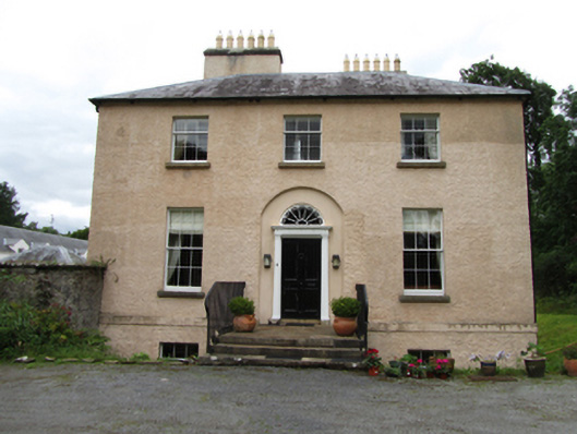 Killinagh Houserectory/glebe/vicarage/curate's house · 1294 yd
 Saint Patrick's Catholic Churchchurch/chapel · 1304 yd
 Kilrooscagh IslandIslet · 1632 yd
 Port IslandCastle, Anglo-Norman masonry castle · 1716 yd
 Lough MacNean WalkWalking route · 1.7 mi
 BarranMountain / peak · 1.8 mi
 Teampull RuisínHeritage attraction · 2.0 mi
 Saint Patrick's Holy WellSpring · 2.0 mi
Other information
Photo: Credit not shown in the picture search · Rights wording not checked; contact us if this picture should be removed