
What is recorded here
In pasture, located on a NW–SE ridge. The ground shelves away steeply for 160m to SW to the shore of Mannin Lake.
Slightly raised, broadly oval area (31.5m N–S; 35.6m E–W) defined by a partly levelled scarp (H 0.6m), outside which it is enclosed by a fosse (Wth 2.2m at SW) with remnants of an external bank (Wth 2.6m; int. H 0.6m; ext. H 0.7m, at SW).
The central platform is relatively level and appears to have been built up on the W half to compensate for the natural fall of ground to NW and SW. The fosse is evident as a shallow depression. The external bank survives at S–NW as a low, dilapidated earth and stone bank; it is levelled at NNW–NE to a slight surface undulation; it is subsumed at ENE–SE into a field fence which preserves the curve of the rath and at SSE–S is levelled to a barely discernible surface rise. Grass cover, with hawthorn bushes around the perimeter.
Compiled by: Jane O’Shaughnessy
Date of upload: 18 February 2022
The monument record does not grant public access. Check the route and ask the landowner before entering private land.
- What survives
- Recorded monument
Places near here
 Kilronan WellHoly well · 437 yd
 CastleCastle, unclassified · 1188 yd
 Promontory fortPromontory fort, inland · 1192 yd
 Mannin Housefarm house · 1220 yd
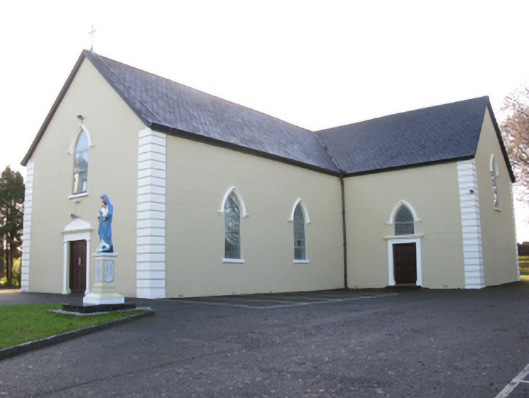 Saint Joseph's Catholic Churchchurch/chapel · 1.5 mi
 Rath Castle in ruinsCastle, tower house · 2.4 mi
 East Mayo Brigade MonumentMemorial · 4.0 mi
 Knock MuseumMuseum · 4.2 mi
 Knock ShrineHeritage attraction · 4.2 mi
 I'll Send You The FareMemorial · 8.0 mi
 Oak WoodForest · 10 mi
 Geoffrey's WoodForest · 11 mi
Other information
Photo: Credit not shown in the picture search · Rights wording not checked; contact us if this picture should be removed