What is recorded here
In Belgooly, indicated as large flour mill on 1842 OS 6-inch map immediately NW of Starch mill (which no longer survives). Flour mill erected in 1832. Incorporated into distillery in late 1870s when it was converted to corn store. Distillery closed in late 1880s and fittings scrapped (Kinsale Newsletter 1989). Single large 6-storey mill survives, similar in L-shaped plan to mill shown on 1842 OS 6-inch map. Half-hipped roof removed; front elevation (S) collapsed. Rock-cut wheel-pit (Wth c. 4m) along E elevation.
The above description is derived from the published 'Archaeological Inventory of County Cork. Volume 2: East and South Cork' (Dublin: Stationery Office, 1994). In certain instances the entries have been revised and updated in the light of recent research.
Date of upload/revision: 14 January 2009
The monument record does not grant public access. Check the route and ask the landowner before entering private land.
- What survives
- Recorded monument
Places near here
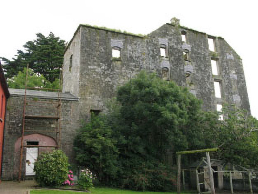 mill (water)mill (water) · 2 yd
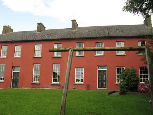 Belgooly Housemill manager's house · 38 yd
 IndicatedHoly well · 632 yd
 Pallastown WoodWood · 1139 yd
 CastleCastle, unclassified · 1683 yd
 Fort (Site of)Fairy fort / earthen ringfort · 1.4 mi
 St Laitiarain's WellSpring · 2.2 mi
 Cullen Castle (Site of)Castle, unclassified · 2.4 mi
 Graveyard in ArdbrackGraveyard · 2.4 mi
 Dermot Ryan's Heritage Town WalksHeritage attraction · 2.8 mi
 Tim & Mortimer McCarthy MemorialMemorial · 2.8 mi
 Spanish Galleon MainmastHeritage attraction · 2.8 mi