What is recorded here
Indicated is a large oval ecclesiastical enclosure on a gentle SE-facing Clare slope, overlooking Lough Atedaun and still marked on maps from 1842 to 1920. Its broken drystone wall, curving laneway and eastern graveyard suggest a old churchland where farming, memory and devotion shared one bounded place. The missing eastern entrance and nearby cross invite wonder about the rituals, burials and daily lives that once filled the grassy oval.
On a gentle SE-facing slope in pasture, overlooking Lough Atedaun c. 230m to the SE. Indicated on both the first (1842) and Cassini (1920) editions of the OS 6-inch map. This large oval-shaped ecclesiastical enclosure (diams. c. 115m WNW-ESE; c. 85m NNE-SSW) is defined from W-N-ENE and from SSE-S-SSW by a collapsed drystone wall overlying a grass-covered stony bank. From SE-SW-W the enclosing line is indicated by a curving laneway. Although no longer identifiable, Swan (1991, 63) suggested that the original entrance may have been at the E, based on the placement of a cross (CL017-119004-) just outside the enclosure there. The enclosure contains a graveyard (CL017-119003-) in the E sector which is also the site of ‘Kilvoydan Church’ (CL017-119002-). A dwelling house and modern farm buildings occupy the W perimeter and NW sector of the enclosure.
Compiled by: Gearóid Conroy and Conn Herriott
Date of upload: 16-10-2025
The monument record does not grant public access. Check the route and ask the landowner before entering private land.
- What survives
- Recorded monument
Places near here
 Killvoydan Church (in ruins)Church · 43 yd
 CrossCross · 84 yd
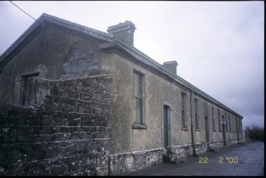 The Old Workhouseworkhouse · 543 yd
 Enclosure in KilvoydanEnclosure · 573 yd
 Ballyporty Castle (in ruins) / TowerCastle, tower house · 1490 yd
 Rock IslandIsland · 1.3 mi
 Inchiquin IslandIslet · 1.5 mi
 Bawn in CregmoherBawn · 1.6 mi
 Battle of TullyodeaBattlefield · 1.8 mi
 Fergus River CaveCave · 3.3 mi
 Ballygriffy WoodWood · 3.5 mi
 Burren National ParkVisitor information · 3.5 mi