What is recorded here
In pasture on slight E-facing slope with moderate views in all directions, on the demesne lands of Kilpeacon House located 365m to NW. Cashel (LI022-022----) lies 80m to S. No surface remains visible. Not depicted as an antiquity on any ed. OS 6-inch map. Depicted as a circular-shaped tree plantation (approx. diam. 31m) on the 1897 OS 25-inch map. Faint trace of cropmark of levelled tree-ring visible on Google Earth orthoimage taken 2017 and 2020. Probably the remains of a tree-ring that was planted in the post-1700 period as part of the landscaping of the demesne lands of Kilpeacon House. Alternatively could have been the remains of a ringfort reused as a tree-ring in the post-1700 period.
See attached Google Earth orthoimages
Compiled by: Fiona Rooney
Date of upload: 27 July 2020
The monument record does not grant public access. Check the route and ask the landowner before entering private land.
- What survives
- Recorded monument
Places near here
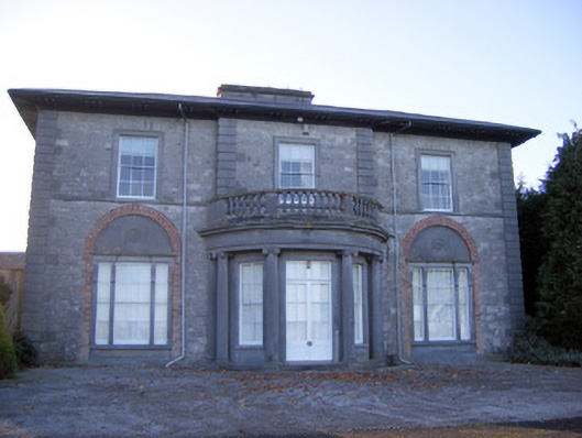 Kilpeacon Housecountry house · 403 yd
 St. Patricks WellHoly well · 484 yd
 Grave YardGraveyard · 644 yd
 Saint Beacon's Church (Kilpeacon)church/chapel · 653 yd
 Villiers WellSpring · 940 yd
 (Site of) Garryellen CastleCastle, unclassified · 1.2 mi
 Dotted outlineBawn · 1.2 mi
 Monasteranenagh AbbeyHeritage attraction · 4.0 mi
 Biodiversity in the Maigue CatchmentVisitor information · 4.8 mi
 European ashEuropean ash · 5.0 mi
 Dysert AenghusaHeritage attraction · 5.6 mi
 Grass IslandIslet · 9.7 mi