
What is recorded here
At the base of a gentle E-facing slope in undulating terrain. The Little Arrigle River flows northward c. 138m to the W where it joins the River Nore c. 310m to the N. Jerpoint Cistercian Abbey (KK028-062005-) lies c. 150m to the SSE. The church is within a small triangular-shaped field with the N wall of the church forming part of the field boundary with the adjoining field to the N, the boundary continues as a post and wire fence to the E and W of the church.
The church is mentioned by Stalley (1987, 247) as being, ‘perhaps the remains of a ‘capella ante portas’’ for Jerpoint Abbey, which is a chapel at or near the gate of the religious house which served visitors as well as those in the abbey’s employ.
A rectangular building (surviving ext. L c. 8.6m; ext. Wth 13.69m) of which only the E gable and part of the N wall (H c. 1.8m; L c. 11.4m of which c. 8.6m is upstanding from the NE angle and then continues as rubble). It is constructed of sandstone rubble, roughly coursed, with quoins consisting of large crudely cut blocks of stone. The E gable wall (H c. 4.3m; T 1.05m) has a base-batter (H 0.75m; Wth 0.15m) and a central window. The E window (H above ground 2.65m; ext. Wth 0.85m) is broken out, only the voussoirs survive, these are small stones set on edge with splayed ingoings (int. Wth 1.85m). The window embrasure is too wide for a single window, it is likely to have accommodated a two-light window. Internally there is a rebate (D c. 0.2m) above the E window.
Unfortunately no architectural features appear to survive, however, the form and shape of the voussoirs would suggest a possible 13th-century date for this church.
Compiled by: Jean Farrelly
The high cross at Jerpoint Abbey was likely erected in the 12th or 13th century by the Cistercian monks of Jerpoint Abbey, which was founded around 1180. The cross is associated with the monastic site and reflects the Romanesque artistic style common in Ireland during the Cistercian period, signifying the abbey's religious and cultural importance in medieval south-east Ireland.
The monument record does not grant public access. Check the route and ask the landowner before entering private land.
- What survives
- Recorded monument
Places near here
 TombTomb, effigial · 11 yd
 Duiske Abbey Catholic Churchchurch/chapel · 14 yd
 Drinking WellMemorial · 23 yd
 Bianconi ArchwayMemorial · 32 yd
 Cross in GraiguenamanaghCross · 40 yd
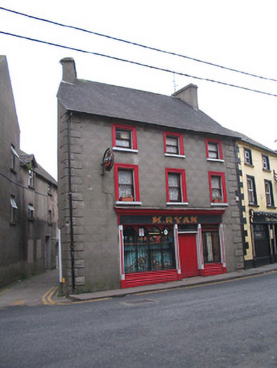 M. Ryanhouse · 47 yd
 Keating's WellSpring · 177 yd
 Tinahinch Castle (in Ruins)Castle, tower house · 468 yd
 ClashgannyWood · 1.4 mi
 CastleCastle, motte · 1.5 mi
 Freney's WellSpring · 1.6 mi
 Gorlough WoodForest · 1.9 mi
Other information
Photo: Credit not shown in the picture search · Rights wording not checked; contact us if this picture should be removed