
What is recorded here
Indicated is a collapsed Clare cashel perched on a steep promontory, its wide stone spread buried under grass and later walls. The SE gap may have been the original entrance, but the thin lintel above it suggests later meddling rather than ancient craft. Standing there, the fort feels less like a ruined house and more like a boundary marker, warning that the land itself remembers shapes long forgotten by people.
On a promontory in rough pasture within a large multiperiod field system (CL005-160001-); the land drops steeply c. 60 to the W and c. 150m to the S. Indicated on the OS 25-inch plan (1897) and the 1920 ed. of the OS 6-inch map. Listed as ‘Enclosure’ in the RMP (1996). This subcircular cashel (24.1m E–W; 22.8m N–S) is defined by a much-collapsed stone wall (Wth including spread 3.5-4.2m). A later drystone wall (Wth c. 0.5m; H 0.5-0.8m) overlies its outer wall-face (max. H 0.6-1m). No trace of the internal wall-face survives, only the grassed-over stone spread (Wth 3-3.5m) is visible. A gap (Wth 1.2m; min. H 1m) at SE may mark the original entrance. However, a lintel (L 2m; T 0.8m; H 0.15m) over it, along the outer wall-face, does not seem to be substantial enough to be an original one, suggesting that this may be a later construction. The gap is not stone lined and there is no visible passageway through the wall. Another gap (Wth 2m) at NE is modern and a buttress (L 2.2m; Wth 1.6m; H 1.6m) has been built against the outer wall-face at ESE. A modern trackway skirts the cashel from SW to NE. An enclosure (CL009-227----) lies c. 55m to the WSW.
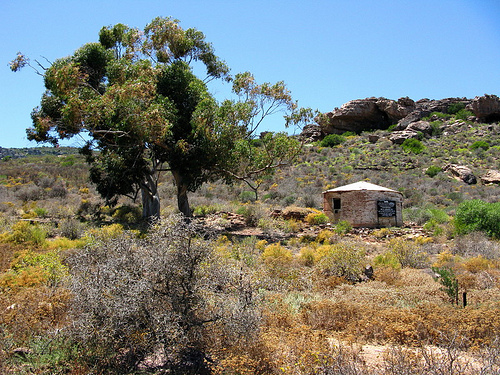
The following image has been uploaded: CL009-052---- view from SE.jpg
Compiled by: Olive Alcock and Conn Herriott
Date of upload: 27 January 2022
The monument record does not grant public access. Check the route and ask the landowner before entering private land.
- What survives
- Recorded monument
Places near here
 Fort and Cave HachuredFairy fort / stone ringfort · 262 yd
 PoulnabroneMemorial · 344 yd
 MonumentMass-rock · 484 yd
 The Portal TombVisitor information · 1527 yd
 Poulnabrone DolmenHeritage attraction · 1539 yd
 Poulnabrone - Burren GeositeVisitor information · 1618 yd
 Caherconnell Stone FortRuins · 1.1 mi
 CaherconnellHeritage attraction · 1.1 mi
 Gleansleade Castle (in ruins)Castle, tower house · 1.3 mi
 Cave of the Wild HorsesCave · 1.9 mi
 Castle (in ruins)Castle, unclassified · 1.9 mi
 Saint Columba's Catholic Churchchurch/chapel · 2.0 mi
Other information
Photo: Credit not shown in the picture search · Rights wording not checked; contact us if this picture should be removed