
What is recorded here
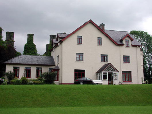
Located on a high bluff overlooking the twisting gorge of this SE-NE section of the River Bonet, with the stream c. 100m to the S and c. 120m to the W. The fortified house and bawn are at the S end of Dromahair village and c. 60m N of the O’Rourke castle (LE014-009----). The house (LE014-008001-) is towards the NE end of a bawn (int. dims 48m NE-SW; 34.7m NW-SE) but is not attached to the bawn wall (H 2-3m; T c. 1m) at any point. The bawn wall only survives on the NE side and partly on the NW and SE and as a wall footing on the SW side. Three gun-loops in small rectangular embrasures (Wth 0.55m; H 0.6m; D 0.8m) with smaller external openings can be seen on the NE wall and there are seven on the NW but a wall-walk, or steps for one, do not survive at any point. There is a small round-headed doorway (Wth 0.85m) in the NW bawn wall, which might be original, as well as an inserted gateway and doorway. The original gatehouse (LE014-008003-) was at the S end of the NW wall and offset to the W. The house is illustrated by Grose (1791, vol. 2, 55-6, Pl. 32), who shows that the bawn wall was not crenelated.
Compiled by: Michael Moore
Date of upload: 1 September, 2016
Built by the O'Rourkes, a Gaelic Irish clan, in the 16th century, Drumahaire Castle was strategically positioned to control local trade routes and defend against English incursions. It is remembered as a symbol of Gaelic resistance in the Bonet Valley during the Tudor conquest of Ireland.
The monument record does not grant public access. Check the route and ask the landowner before entering private land.
- What survives
- Recorded monument
Places near here
 The Lodgehouse · 18 yd
 post boxpost box · 58 yd
 Old HallCastle, hall-house · 69 yd
 Enclosure in MullanaskeaghEnclosure · 669 yd
 Doonbran Isd.Bawn · 1.5 mi
 Cullentra ForestForest · 2.0 mi
 Green IslandIslet · 2.1 mi
 Trawane BayBay · 2.5 mi
 InnisfreeIslet · 2.6 mi
 Parke's CastleHeritage attraction · 2.9 mi
 SlishwoodWood · 3.4 mi
Other information
Photo: Credit not shown in the picture search · Rights wording not checked; contact us if this picture should be removed