What is recorded here
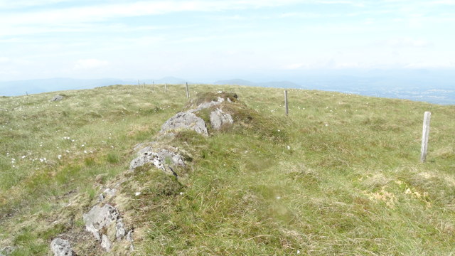
In rough hill pasture, on a SW-facing slope, overlooking the valley of the Sheen River. Partially collapsed stone walls (T 0.7m; H 0.6m) radiate from an enclosure (KE102-074002-) and suggest a field system extending haphazardly over an area measuring c. 750m E-W x c. 350m N-S. The lower courses of the walls are grass-covered and occasionally protrude from shallow bog. The walls, through which several gaps occur, are generally curvilinear and enclose fields of many shapes and sizes. Within the field system are four enclosures (KE102-074002-, KE102-074005-, KE102-074008-, KE102-074010-), five hut sites (KE102-074003-, KE102-074006-, KE102-074009-, KE102-074011-, KE102-074012-) and two cairns (KE102-074004-, KE102-074007-).
The above description is derived from the published 'Archaeological Inventory of County Kerry. Volume I: South-West Kerry' (Dublin: Stationery Office, 2009). In certain instances the entries have been revised and updated in the light of recent research.
Date of upload: 30 May 2011
The monument record does not grant public access. Check the route and ask the landowner before entering private land.
- What survives
- Recorded monument
Places near here
 Hut site in CrinagortHut site · 87 yd
 IndicatedEnclosure · 319 yd
 Famine RuinRuins · 729 yd
 Bullaun StoneHeritage attraction · 735 yd
 Bonane Heritage ParkMuseum · 960 yd
 Glashagarriv Br.Bridge · 1185 yd
 BeneenMountain / peak · 1.4 mi
 KnocknamanaghMountain / peak · 1.7 mi
 The Priests LeapViewpoint · 3.1 mi
 CaoinkeenCliff · 3.1 mi
 CastleCastle, unclassified · 3.8 mi
 Mucksna Nature ReserveNature reserve · 4.4 mi