
What is recorded here
On outer W bank of ringfort (12362). Front elevation (H c. 5m; Wth 4.5m) has blocked arched recess (Wth 1.9m). Forecourt filled with slurry. Concrete water tank atop kiln. Second kiln c. 20m to NE, indicated on 1842 OS 6-inch map, no longer survives.
The above description is derived from the published 'Archaeological Inventory of County Cork. Volume 4: North Cork' (Dublin: Stationery Office, 2000). In certain instances the entries have been revised and updated in the light of recent research.
Date of upload/revision: 14 January 2009
The monument record does not grant public access. Check the route and ask the landowner before entering private land.
- What survives
- Recorded monument
Places near here
 LisabramFairy fort / earthen ringfort · 651 yd
 Charles's Bridgebridge · 836 yd
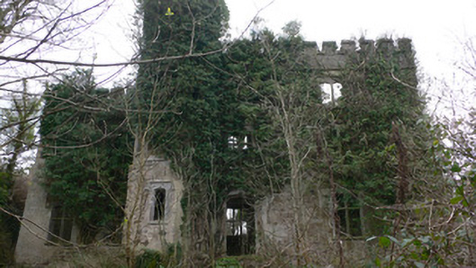 Duarrigle Castlecountry house · 974 yd
 Fulacht FiadhFulacht fia · 1511 yd
 Dromsicane Castle (in Ruins)Bawn · 1.7 mi
 Castle and TurretCastle, tower house · 2.6 mi
 Millstreet Museum & Tourist Information CentreMuseum · 2.6 mi
 Claragh Loop (Trailhead 99)Visitor information · 2.7 mi
 Millstreet Tourist InformationVisitor information · 2.7 mi
 Claragh MountainMountain / peak · 2.9 mi
 RowanRowan · 3.4 mi
 CurracahillMountain / peak · 4.2 mi
Other information
Photo: Credit not shown in the picture search · Rights wording not checked; contact us if this picture should be removed