What is recorded here
Indicated is a circular stone fort in a small triangular Mayo pasture, its broad bank reduced to a steep scarp on the south and swallowed by hawthorn, ash and holly. Local tradition places a hidden cave beneath the slight central rise, though no entrance is visible through the scattered stone and dense growth. The fort may have been a dwelling, a refuge or a marker for that concealed passage, but the thicket keeps its purpose out of reach.
In pasture, boxed into a small triangular field, located on a low rise.
Circular area (c. 27m N-S) defined by a stony bank (Wth c. 4m; int. H 0.5m; ext. H 0.6-0.7m), reduced to a scarp (H 1.45m at S) at SE−S. The bank/scarp is topped with stone, and remnants of external stone facing are evident at E and S. It is unclear to what extent this is original walling or the result of later modification. At the NE and NW the bank is incorporated into the line of later field walls.
Overgrowth made inspection of the interior difficult. There is much stone scattered throughout. Roughly in the centre of the interior there is a gently raised area (diam. c. 5-6m), the S edge of which is defined by an E-W row of at least four medium-sized stones. The significance of this feature is uncertain, but it is possible that it relates to a Man-made underground passage ('cave') (MA063-026001), which according to local tradition is located somewhere in the interior. The cashel is engulfed in a dense thicket of hawthorn, ash, holly, and surrounded by loose heaps of field clearance stone.
Compiled by: Jane O'Shaughnessy
Date of upload: 9 July 2020
The monument record does not grant public access. Check the route and ask the landowner before entering private land.
- What survives
- Recorded monument
Places near here
 Cloonfane National Schoolschool · 900 yd
 IndicatedFairy fort / earthen ringfort · 1.2 mi
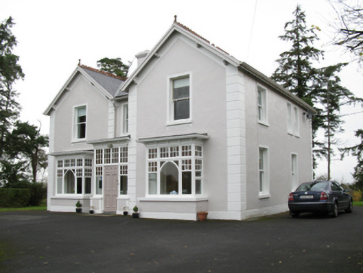 presbytery/parochial/curate's housepresbytery/parochial/curate's house · 1.3 mi
 Enclosure in Lavy MoreEnclosure · 1.4 mi
 Old Cave Burial GroundArchaeological place · 3.0 mi
 Bockagh HillMountain / peak · 5.1 mi
 Casatle (ruins)Castle, unclassified · 6.4 mi
 Crunaun Castle (in ruins)Castle, unclassified · 6.9 mi
 East Mayo Brigade MonumentMemorial · 8.1 mi
 Crow IslandIslet · 11 mi
 Castle PointHeadland · 12 mi
 Druminagh WoodForest · 12 mi