What is recorded here
Indicated is a fairy fort in County Mayo, an oval ring of earth and slope where the western bank still stands but the eastern edge has surrendered to natural ground. It sits on a knoll above flat pasture and bog, exposing anyone inside to the wide sky and distant travel. The name suggests direction rather than identity, as if the place existed to be pointed at before it was understood.
In pasture, located on the N side of a knoll/small ridge. There are extensive views, especially to N where the ground falls away to a flat expanse of pasture and bog.
Raised, roughly oval (c. 35m N-S; c. 27m E-W) defined in a broad curve on the W arc by a pronounced earthen scarp (Wth slope 3.5m; H 1.6m, at W). The E half of the enclosure is defined by the shallow curve of a broadly sloping natural fall of ground with no evidence of a man-made enclosing element. A short section of bank, stone faced on the external slope, is evident at SE, which may be a remnant of an original enclosing bank now incorporated into an E-W field fence. A narrow, shallow gully (Wth 0.6m) cuts through the scarp at SSW. On the NW arc there is a slight terrace (Wth 1.6-2m) at the base of the enclosing scarp. The interior of the rath is level and featureless.
Dense overgrowth cloaks the perimeter at N and also at SE−S, where the field boundary intersects with the enclosure. There is an old quarry/sand-pit immediately to S of the rath. A Man-made underground passage (MA062-059001-) is located at the base of the slope 20m to N.
Compiled by: Jane O’Shaughnessy
Date of upload: 30 November 2020
The monument record does not grant public access. Check the route and ask the landowner before entering private land.
- What survives
- Recorded monument
Places near here
 bridgebridge · 1701 yd
 IndicatedFairy fort / earthen ringfort · 1.1 mi
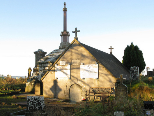 mausoleummausoleum · 1.6 mi
 Enclosure in KillaturlyEnclosure · 1.8 mi
 Procession Of The SoulsMemorial · 1.9 mi
 Brabazon WoodsForest · 2.0 mi
 Youth Memorial GardenMemorial · 2.3 mi
 HawthornHawthorn · 3.3 mi
 Castle (in Ruins)Castle, unclassified · 3.7 mi
 Hennigan's Heritage CentreHeritage attraction · 3.8 mi
 Thorn CaveCave · 5.1 mi
 Kiltimagh MuseumMuseum · 8.2 mi