What is recorded here
Indicated is a fairy fort or earthen ringfort in Carrownagleragh, County Sligo, Ireland. It occupies a narrow pasture ridge with two earthen banks, a central fosse, and an eastern entrance showing traces of stone facing. The inner bank contains stone revetment on its south and west arcs, while field boundaries have replaced parts of the outer bank on the north and east.
In pasture, on top of a narrow ridge. A raised circular area (37.1m N-S; 34.8m E-W) enclosed by two earthen banks and an intervening fosse. The inner bank (Wth 7.1m; int. H 1.7m; ext. H 3.15m) has traces of internal stone revetment along the S and W arcs and at NNE its external slope has been quarried into for a distance of 6m. The intervening fosse (Wth 4m) is evident all round apart from E-ESE. The outer bank (Wth 4.3m; int. H 1m; ext. H 1m) is evident all round apart from N-NNE where it has been incorporated into a field boundary and E-ESE where it is levelled and replaced by a field boundary. At N a small section of the external slope of the outer bank has been quarried into. The S half of the interior is slightly higher than the N half with a gentle slope down to NE and E. The entrance (Wth 1.4m) is at E, with traces of possible stone-facing visible.
The above description is derived from the published 'Archaeological Inventory of County Sligo' compiled by Ursula Egan, Elizabeth Byrne, Mary Sleeman with Sheila Ronan and Connie Murphy (Dublin Stationery Office, 2005).
Date of upload: 18 January 2008
The monument record does not grant public access. Check the route and ask the landowner before entering private land.
- What survives
- Recorded monument
Places near here
 Church (in Ruins)Church · 680 yd
 IndicatedFairy fort / earthen ringfort · 694 yd
 Ecclesiastical enclosure in Kilvarnet NorthEcclesiastical enclosure · 1613 yd
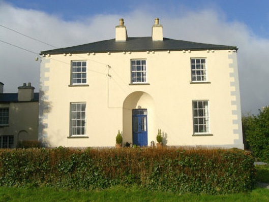 Rathbarran Houserectory/glebe/vicarage/curate's house · 1.3 mi
 European ashEuropean ash · 1.8 mi
 ElderElder · 2.4 mi
 CastleCastle, unclassified · 3.0 mi
 Moymlough Castle (in Ruins)Castle, tower house · 3.3 mi
 Tullaghan HillMountain / peak · 3.5 mi
 DoomoreMountain / peak · 3.9 mi
 Brother WalfridMemorial · 5.4 mi
 James MorrisonMemorial · 7.0 mi