What is recorded here
Indicated is a levelled fairy fort in County Limerick, Ireland, where a curved field boundary still marks the vanished oval earthwork. The 1840 Ordnance Survey called it Sweeps Fort, a circular fort on the road dividing the townland from Church Quarter. It may have sheltered people, excluded carts or simply marked the edge of human claim.
In level pasture with moderate views in all directions. Depicted as an oval-shaped earthwork in S corner of field on 1840 ed. OSi 6-inch map. A curve in the field boundary in S corner of field marks site of levelled earthwork. In 1840 the Ordnance Survey recorded the following; ‘Sweeps Fort, situated on N side of road which divides that townland from Church Quarter. The name of a circular fort’ (OSNB).
See attached Google Earth orthoimage
Compiled by: Caimin O'Brien
Date of upload: 27 October 2021
The monument record does not grant public access. Check the route and ask the landowner before entering private land.
- What survives
- Recorded monument
Places near here
 EnclosureEnclosure, large enclosure · 47 yd
 Kilbeheny Church (in ruins)Church · 475 yd
 Grave YardGraveyard · 483 yd
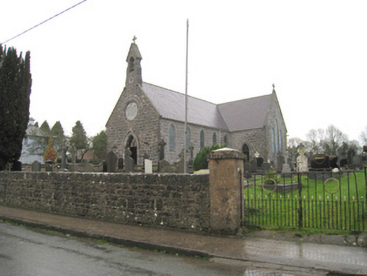 Saint Joseph's Catholic Churchchurch/chapel · 608 yd
 Kilbeheny Castle (in ruins)Castle, tower house · 1.2 mi
 Coopers WoodWood · 2.6 mi
 CastleCastle, ringwork · 2.8 mi
 Eagles StepCliff · 3.0 mi
 Seefin North TopMountain / peak · 3.2 mi
 Combaun WoodsViewpoint · 3.7 mi
 John MandevilleMemorial · 3.7 mi
 Mitchelstown Town MapVisitor information · 3.7 mi