
What is recorded here
On the S-sloping edge of an E-W ridge overlooking the River Suir and a small lake c. 150m to the S, in an area of undulating ground with outcrop to the N of the tower house. According to the Civil Survey (1654-6) the Countess of Ormond was the proprietor in 1640 and 'On the sd. lands stands a castle Demolished with a Bawne on one side thereof together with a thatcht house a few cabblins all Inhabitted (Simington 1934, vol. 2, 9). Incorporated into the SW angle of Ballynahinch bawn (TS060-059003-) there is an internal building (int. dims. 13.4m N-S; 18.9m E-W), the S wall of the bawn within this building has three openings which were possibly broken out to form windows and there is one large opening in the W wall. The wall forming the E gable is not keyed into the bawn wall. Only the E end of the N wall survives (T 0.8m; L 6.85m). The interior is sunken. Both the E and N wall are composed of limestone rubble, roughly coursed.
Compiled by: Jean Farrelly
Date of upload: 26 August 2011
The monument record does not grant public access. Check the route and ask the landowner before entering private land.
- What survives
- Recorded monument
Places near here
 Ballynahinch Castle (in ruins)Castle, tower house · 23 yd
 Settlement cluster in Ballynahinch (ballygriffin Par.)Settlement cluster · 238 yd
 Field system in CastlelakeField system · 433 yd
 Ballynahinch Church (in ruins)Church · 552 yd
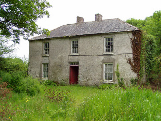 Castlelake Millmiller's house · 659 yd
 Camus Castle (in ruins)Castle, unclassified · 1.5 mi
 Hore AbbeyHeritage attraction · 2.1 mi
 Athassel PrioryHeritage attraction · 3.1 mi
 Dundrum Woods (Marl Bog)Forest · 5.3 mi
 Maudemount BogWood · 6.0 mi
 I.R.A. 3rd. Tipperary Brigade MemorialMemorial · 8.7 mi
 Soloheadbeg Ambushambush · 8.9 mi
Other information
Photo: Credit not shown in the picture search · Rights wording not checked; contact us if this picture should be removed