
What is recorded here
On a slight break of a NE-facing slope, in pasture. There are good views in all directions, except upslope to the S. A rectangular enclosure (dims. c. 65.6m NE-SW; c. 55m NW-SE) identified on an aerial photograph (GB90.AX.08) which is also visible on satellite imagery (Google Earth, imagery date 16 April 2020). The enclosure and a number of buildings within are indicated on the 1st (1839) ed. OS 6-inch map but are not depicted on the 1900 revision. Within the enclosure there is a castle (KK013-017001-) near the W edge and a 17th-century house (KK013-017002-) c. 30m SE of the castle. It is likely the rectangular enclosure is a bawn, possibly associated with the castle. It consists of a bank, largely reduced to scarp (H 0.87m; Wth 2.6m) with a fosse (Wth 3.52m; ext. H 0.37m) and outer bank (Wth at crest 2.6m; Wth at base 6.2m; ext. H 0.33m). The outer bank is visible along the W side and appears to have been incorporated into a field boundary along the N and E sides. Both banks and fosse are very denuded along much the S side.
See attached photos:
KK013-140----_01Google Earth satellite image, imagery date 16 April 2020
KK013-140----_02 Bank of bawn in foreground with remains of house and castle
KK013-140----_03 SW angle of bawn with ranging-rod in fosse
KK013-140----_04 N end of NW side from NW
KK013-140----_05 E side of bawn from S
Compiled by: Jean Farrelly
Date of revised upload: 13 September 2022
A local castle; wider significance not recorded.
The monument record does not grant public access. Check the route and ask the landowner before entering private land.
- What survives
- Recorded monument
Places near here
 Abbey in ruinsChurch · 83 yd
 CastleCastle, motte · 112 yd
 Site of English's houseArchaeological place · 424 yd
 Enclosure in Ballylarkin LowerEnclosure · 586 yd
 The CopseWood · 856 yd
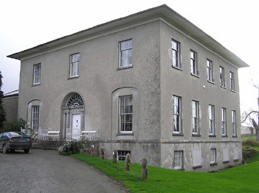 Kilrush Housecountry house · 1203 yd
 The PondsForest · 1278 yd
 Upper CourtCastle, unclassified · 1516 yd
 Freshford LoopWalking route · 1587 yd
 Emma Jane Browne-ClaytonMemorial · 1.4 mi
 Clomantagh HillMountain / peak · 3.5 mi
 DelaneyMemorial · 5.6 mi
Other information
Photo: Credit not shown in the picture search · Rights wording not checked; contact us if this picture should be removed