What is recorded here
Situated on a fairly level landscape. The church (WX047-036----) is within a rectangular, grass-covered enclosure with some trees (dims 22m N-S; 21m E-W) defined by earthen banks (Wth c. 3m; int. H 0.5m; ext. H 0.8-1.4m) with entrances at W (Wth 1.2m) and S (Wth 1.85m). There is no indication of burial.
Compiled by: Michael Moore
Date of upload: 17 October, 2013
A local church or high cross; wider significance not recorded.
The monument record does not grant public access. Check the route and ask the landowner before entering private land.
- What survives
- Recorded monument
Places near here
 Silverspring Housegates/railings/walls · 571 yd
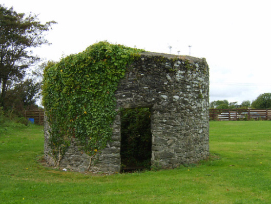 mill (wind)mill (wind) · 592 yd
 CastleCastle, tower house · 1104 yd
 St. Catherines WellHoly well · 1395 yd
 The Heron's MeadowForest · 1518 yd
 Enclosure in GraniskEnclosure · 1659 yd
 The Bull RockForest · 1.0 mi
 1798 Memorial PlaqueMemorial · 1.5 mi
 Ballyrane Castle (in ruins)Castle, tower house · 1.8 mi
 The HamBay · 2.7 mi
 The White Hole BeachBeach / strand · 3.2 mi
 Sigginstown Island (Great)Island · 3.4 mi
Other information
Photo: Credit not shown in the picture search · Rights wording not checked; contact us if this picture should be removed