What is recorded here
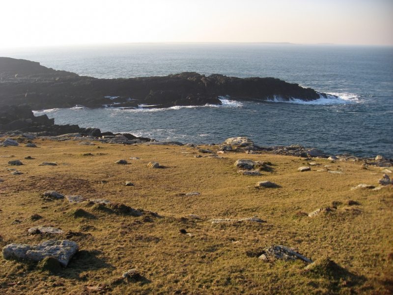
Indicated is a levelled fairy fort on Annagh Island in Lough Conn, where a low southern arc still catches the eye beneath pasture and memory. It faces the mainland across open water, inviting people to imagine who stood there, watched the lake, and left behind only a faint circular shadow. The field fence cuts through the remains like a later hand rewriting an older story, yet the shape resists forgetting.
In pasture, located on the S half of Annagh Island in the NE end of Lough Conn. It utilises a rise with a fall of ground on the E side, and has excellent views across the lake and E to the mainland.
This enclosure, most likely a rath, has been levelled. It is indicated on the 1838 and 1930 OS 6-inch maps as a circular embanked enclosure (diam. c. 30m), with an E–W field fence extending to E and W of the bank. The circular outline (diam. 35m) of the rath which can still be traced, bisected by the E-W field fence. The N arc of the rath is barely discernible; the S half is evident as a low semicircular platform defined by a partly levelled scarp (H 0.7m).
Compiled by: Jane O'Shaughnessy
Date of upload: 21 February 2020
The monument record does not grant public access. Check the route and ask the landowner before entering private land.
- What survives
- Recorded monument
Places near here
 RathnashuppyFairy fort / earthen ringfort · 1153 yd
 RathmweelFairy fort / earthen ringfort · 1317 yd
 TempleancloghanChurch · 1623 yd
 Saint Teresa's Catholic Churchchurch/chapel · 1.1 mi
 Cloghans CastleCastle, tower house · 1.3 mi
 Castle Kelly (in Ruins)Castle, motte · 1.7 mi
 Roe IslandIslet · 1.9 mi
 Castle IslandIslet · 2.2 mi
 Titanic Memorial ParkMemorial · 4.3 mi
 Battle of Ballinabattle · 4.4 miHumbert MonumentMemorial · 4.7 mi
 The Marshall Doran CollectionGallery · 5.8 mi
Other information
Photo: Credit not shown in the picture search · Rights wording not checked; contact us if this picture should be removed