What is recorded here
Doonnagore Castle watches from 140m away, but the hut faces north into the weather, its grass-covered wall reduced to 25cm on a ridge where pasture still grows. The interior sits 25cm below the ground, a shallow bowl that may have held heat, shadow or simply a person waiting out the wind. Its exact age has slipped away, yet the shape remains clear enough to imagine hands stacking stone before the castle rose.
On the N-facing slope of a prominent ridge, in rough pasture. This possible circular hut site (int. diam. 4.5m; ext. dims. 11m E-W; 7.5m N-S) is defined by a collapsed and grass-covered wall (max. H 0.25m). The interior is lower (D 0.25m) than the surrounding ground level. Doonnagore Castle (CL008-087----) lies c. 140m to SW.
Summary by: Gearóid Conroy and Conn Herriott
Date of upload: 6 December 2022
The monument record does not grant public access. Check the route and ask the landowner before entering private land.
- What survives
- Recorded monument
Places near here
 Doonagore Castle in ruinsCastle, tower house · 162 yd
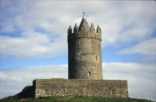 Doonnagore Castlecastle/fortified house · 162 yd
 CaherEnclosure · 361 yd
 Enclosure in DoonnagoreEnclosure · 493 yd
 bridgebridge · 970 yd
 Doonmacfelim Castle (in Ruins)Castle, tower house · 1236 yd
 Fisherstreet PotCave · 1297 yd
 Doolin FerriesHeritage attraction · 1.1 mi
 Wild Atlantic Way: Doolin PierVisitor information · 1.1 mi
 Ballaghaline PointHeadland · 1.2 mi
 Doolin Cliff WalkWalking route · 1.3 mi
 Doolin PointHeadland · 1.4 mi