What is recorded here
In the vicinity of a ringfort (GA057-154----). The foundations of three houses have been identified as follows: (a) c. 50m to SE of the ringfort is a poorly preserved circular house (D 2.8m) defined by a grassed-over stone wall which survives from S through W to NNE. Traces of inner and outer wall-facing are visible; (b) adjoining the outer face of the latter at WSW are slight traces of a subcircular house (NE-SW; L 3m, Wth 2.5m) of similar construction; (c) some 11m N of the ringfort is a clearly defined rectangular house (E-W; L 10m, Wth 3.6m) indicated by a double-faced wall of limestone blocks.
The above description is derived from the published 'Archaeological Inventory of County Galway Vol. II - North Galway'. Compiled by Olive Alcock, Kathy de hÓra and Paul Gosling (Dublin: Stationery Office, 1999).
Date of upload: 05 August 2010
The monument record does not grant public access. Check the route and ask the landowner before entering private land.
- What survives
- Recorded monument
Places near here
 IndicatedFairy fort / stone ringfort · 46 yd
 Church in AucloggeenChurch · 1328 yd
 Megalithic structure in BolisheenMegalithic structure · 1.1 mi
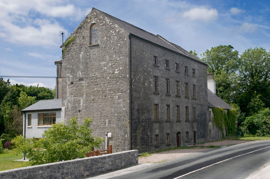 Cregg Millsmill (water) · 1.6 mi
 Cregg Castle DemesneForest · 1.6 mi
 Cregboyne FortBawn · 1.7 mi
 Drumgriffin Castle (in ruins)Castle, unclassified · 2.0 mi
 European BeechEuropean Beech · 3.4 mi
 Kilcoona Round TowerHeritage attraction · 4.2 mi
 Ballinduff BayBay · 4.4 mi
 Oileán an AoilIsland · 6.1 mi
 Oileán an BhreathnaighIslet · 6.1 mi