What is recorded here
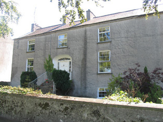
Seventeenth-century house descibed in the Civil Survey as one thatch house (Simington 1934, Vol. 2, 336) had been tentatively located at the main house in the townland, 'Fort Nisbett'. Field inspection in 1995 established that there is no pre-1700 house in this area. ' Fort Nisbett' is a two-storey house of early to mid- 18th century date. The seventeenth-century house remains unlocated within the townland.
The above description is derived from 'The Archaeological Inventory of County Tipperary. Vol. 1 - North Tipperary' compiled by Jean Farrelly and Caimin O'Brien (Dublin: Stationery Office, 2002). In certain instances the entries have been revised and updated in the light of recent research.
Date of upload/revision: 22 September 2008
The monument record does not grant public access. Check the route and ask the landowner before entering private land.
- What survives
- Recorded monument
Places near here
 Borrisokane Churchchurch/chapel · 1324 yd
 Réalt na Marahouse · 1339 yd
 BorrisokaneHistoric town · 1424 yd
 Enclosure in CrottaEnclosure · 1573 yd
 Bawn in CloghkeatingBawn · 1.5 mi
 Drumnamahane CastleCastle · 1.5 mi
 Borris WoodWood · 1.9 mi
 Knockanacree WoodForest · 3.7 mi
 MacDonagh HouseMemorial · 4.2 mi
 Thomas MacDonagh Heritage CentreMuseum · 4.2 mi
 Knigh HillMountain / peak · 6.2 mi
 James Devaney MemorialMemorial · 6.3 mi