What is recorded here
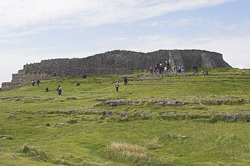
This is one of four possible house sites (see also GA110-039021-, GA110-039023- and GA110-039024-) that were uncovered during the course of excavations in the SW part of Cutting 1, in the inner enclosure of Dún Aonghasa (GA110-039----). This example, identified as Structure 7, was located 1.5m to the S of Structure 1 (GA110-039021-). The only evidence of its existence consisted of an upright slab and a fragment of a second contiguous slab. They projected at a slight angle from the deposits underlying the enclosure wall. In size and appearance the blocks resembled the revetment wall in structures 1 and 9 (GA110-039023-). It was not possible to determine whether the remains had formed the N or S wall of the house. There was no trace of an occupation surface and no definitely associated features were identified (Cotter 2012, vol. 1, 349-50, 357, 360).
Compiled by: Olive Alcock
Date of upload: 23 June 2020
The monument record does not grant public access. Check the route and ask the landowner before entering private land.
- What survives
- Recorded monument
Places near here
 DunaengusCliff-edge fort · 21 yd
 Dún AonghasaNature reserve · 57 yd
 Not locatedStructure · 79 yd
 Kilmurvey BeachBeach / strand · 334 yd
 TemplenaneeveChurch · 965 yd
 IndicatedChurch · 1410 yd
 Castle (in ruins)Castle, unclassified · 1.6 mi
 ÁrainnIsland · 1.6 mi
 An CharcairMountain / peak · 2.0 mi
 Seal Colony LookoutViewpoint · 2.4 mi
 An tOileán ThiarIslet · 3.5 mi
 Trá na mBuailte (Beach of the Booly)Beach / strand · 4.0 mi