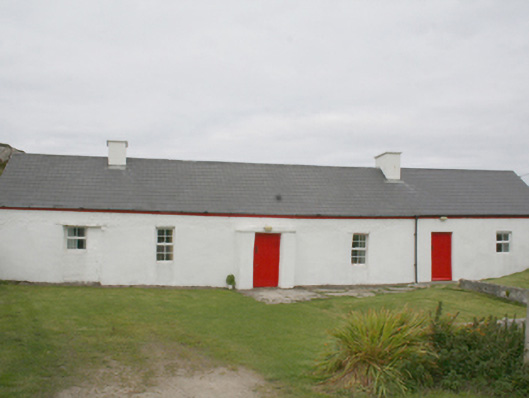
What is recorded here
Detached five-bay single-storey direct entry house, c.1875, on a rectangular plan originally three-bay single-storey centred on single-bay single-storey gabled windbreak. Reroofed, 1982. Extended, 1999-2000, producing present composition. Replacement pitched artificial slate roof with ridge tiles, cement rendered chimney stacks having concrete capping, and rainwater goods on timber eaves boards with downpipes. Raised rendered battered walls; part rendered repointed rubble stone wall (north) with limewashed bed outshot or buttress. Square-headed central door opening with concealed dressings including lintel framing timber boarded door. Square-headed window openings with concealed dressings framing replacement uPVC casement windows. Square-headed central window opening to rear (north) elevation with remains of rendered sill, and concealed dressings including lintel framing two-over-two timber sash window. Set in own grounds.
A house identified as an integral component of the nineteenth-century vernacular heritage of north County Donegal by such attributes as the compact direct entry plan form centred on a characteristic windbreak; the construction in unrefined local fieldstone displaying a feint battered silhouette; the disproportionate bias of solid to void in the massing; and the high pitched roof originally showing a thatch finish according to the "House and Building Return" Form of the National Census: meanwhile, aspects of the composition clearly illustrate the continued linear development of the house into the twenty-first century with one addition repurposing a byre or cowhouse. Furthermore, an adjacent "tin roofed" outbuilding continues to contribute positively to the group and setting values of a self-contained ensemble making a pleasing visual statement overlooking Sloddan Port.
This does not grant access. Most recorded buildings are privately owned; view them only from public ground unless the owner allows entry.
Places near here
 Altars (Site of)Penal Mass station · 63 yd
 Dunaff Coastal Promontory FortPromontory fort, coastal · 512 yd
 Dunaff Hill Signal StationRuins · 1360 yd
 Dunaff HillMountain / peak · 1523 yd
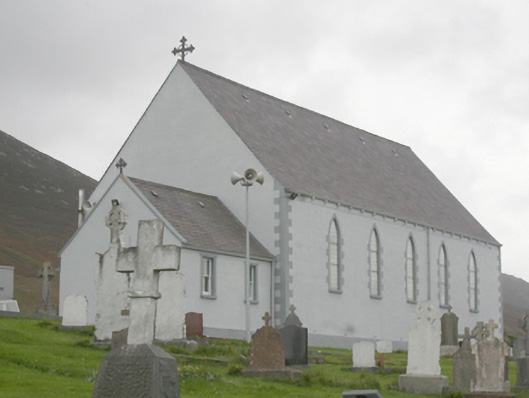 St. Michael’s Catholic Churchchurch/chapel · 1.2 mi
 Raghtin MoreMountain / peak · 2.2 mi
 Glenevin WaterfallWaterfall · 2.5 mi
 Glenevin Waterfall, Clonmanywaterfall · 2.5 mi
 Glenevin Waterfall WalkOfficial walking route · 2.5 mi
 Clonmany Early Church GraveyardGraveyard · 2.8 mi
 Gap of Mamore ViewpointViewpoint · 2.9 mi
 Mamore GapViewpoint · 3.5 mi
Other information
Photo: National Inventory of Architectural Heritage · Website use allowed for educational or private purposes with source credit