What is recorded here
Armagh has continued as a settled place from prehistoric times through the modern day, an unbroken thread of human life rather than a single founded town. The ground has carried E.CHRIST., MEDIEVAL, LATE-MED, POST-MED and MODERN hands, each adding its own claims, routines and memories to the same soil. Its continuity is the remarkable part: a place still occupied, still changing, still making people return.
The official Northern Ireland record identifies this as HISTORIC SETTLEMENT (Prehistoric-Present): ARMAGH. Recorded period: PREHISTORIC; E.CHRIST.; MEDIEVAL; LATE-MED; POST-MED; MODERN. The official map point was placed at the centre of the recorded archaeological site from the source map reference.
The monument record does not grant public access. Check the route and ask the landowner before entering private land.
- What survives
- Recorded monument
Places near here
 No 5 Vicars' HillMuseum · 33 yd
 MULTIPERIOD CHURCH SITE & GRAVEYARD with ROUND TOWER, BIVALLATE ENCLOSURE & LIBRARY, now CATHEDRAL: CHURCH of the ELECTIONS, ST. PATRICK'S CATHEDRAL in CorporationMULTIPERIOD CHURCH SITE & GRAVEYARD with ROUND TOWER, BIVALLATE ENCLOSURE & LIBRARY, now CATHEDRAL: CHURCH of the ELECTIONS, ST. PATRICK'S CATHEDRAL · 54 yd
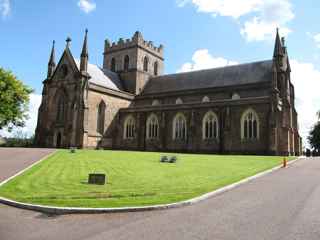 CHURCH: THE TOI; CHURCH OF THE ELECTIONS in ArmaghCHURCH: THE TOI; CHURCH OF THE ELECTIONS · 70 yd
 Public LibraryLibrary · 73 yd
 Abbey StreetVisitor information · 178 yd
 Battle of ClontibretMajor battlefield · 236 yd
 Boer War memorialMemorial · 426 yd
 Crimean CannonMemorial · 428 yd
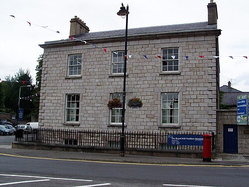 Royal Irish Fusiliers MuseumMuseum · 466 yd
 Armagh FriaryArchaeological place · 514 yd
 Battle of the Yellow FordMajor battlefield · 532 yd
 Cannon HillViewpoint · 3.4 mi