
What is recorded here
Enclosure (max. int. diam. NW-SE c. 45m) situated on highest point of hill defined by bank at W, scarp at S and E, N side levelled. Originally had a bank with exterior fosse all the way round but now much degraded.
Recently described in the Atlas of Hillforts of Britain and Ireland as following; 'Sub-rectangular contour fort with a total site footprint of approximately 0.4ha positioned at summit of domed hilltop at the E edge of an isolated hill ridge. Univallate for the entire circuit with no obvious entrance features recorded. No evidence for any internal features on the surface. Rampart has been heavily affected by ploughing and is visible as a low scarp at the E, S and W. Originally the enclosing elements had an external ditch (O'Brien and Sweetman, 1997). First map depiction in first edition Ordnance Survey mapping. More detailed earthwork survey in second edition Ordnance Survey mapping. Site survey by O'Brien and Sweetman in 1997.' (http://hillforts.arch.ox.ac.uk/records/IR0987.html)
The above description is derived from the published 'Archaeological Inventory of County Offaly' (Dublin: Stationery Office, 1997). In certain instances the entries have been revised and updated in the light of recent research.
Compiled and revised by: Caimin O'Brien
Date of revised upload: 6 February 2020
The monument record does not grant public access. Check the route and ask the landowner before entering private land.
- What survives
- Recorded monument
Places near here
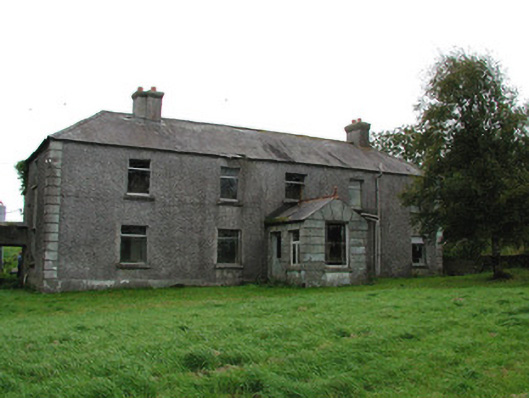 Barrysbrook Housefarm house · 667 yd
 Children's Burial GroundArchaeological place · 682 yd
 The Togher of CroghanRoad, unclassified togher · 965 yd
 Site of Lady Mary Warrens CastleCastle, unclassified · 966 yd
 StructureStructure, peatland · 1202 yd
 OutlinedBawn · 1.2 mi
 Croghan Hill WalkVisitor information · 1.4 mi
 Croghan HillMountain / peak · 1.4 mi
 Finnrenashark Holy WellSpring · 1.5 mi
 Holy PlantationForest · 1.5 mi
 Victoria PlantationWood · 1.6 mi
 Clonin EarthworksMountain / peak · 1.8 mi
Other information
Photo: Credit not shown in the picture search · Rights wording not checked; contact us if this picture should be removed