What is recorded here
During the course of research excavations in the W half of the inner enclosure at Dún Aonghasa (GA110-039----) two hearths (F218: GA110-039010-) and (F212: GA110-039011-) were revealed to the N of a pit (F234: GA110-039009-).
This hearth consisted of a large flat limestone slab that appeared to have been deliberately positioned. A slight concentration of charcoal and fish bone occurred at the E side of the slab, suggesting that it had some function related to the preparation or cooking of food. It was 3.4m to the NE of the other hearth (GA110-039010-) (Cotter 2012, vol. 1, 319-20). Two more hearths (GA110-039012- and GA110-039013-) were uncovered to the S of the pit. All these features date to the Late Bronze Age (ibid., 316).
Compiled by: Olive Alcock
Date of upload: 22 June 2020
The monument record does not grant public access. Check the route and ask the landowner before entering private land.
- What survives
- Recorded monument
Places near here
 DunaengusCliff-edge fort · 19 yd
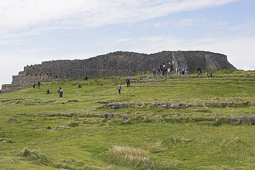 Dún AonghasaNature reserve · 53 yd
 Not locatedStructure · 74 yd
 Kilmurvey BeachBeach / strand · 328 yd
 TemplenaneeveChurch · 960 yd
 IndicatedChurch · 1406 yd
 Castle (in ruins)Castle, unclassified · 1.6 mi
 ÁrainnIsland · 1.6 mi
 An CharcairMountain / peak · 2.0 mi
 Seal Colony LookoutViewpoint · 2.4 mi
 An tOileán ThiarIslet · 3.5 mi
 Trá na mBuailte (Beach of the Booly)Beach / strand · 4.0 mi