What is recorded here
During the course of research excavations at Dún Aonghasa (GA110-039----) a 'hollow', identified as F1009, in the E sector of interior of the inner enclosure was investigated (in Cutting 11). Prior to the construction of the enclosing wall the hollow would have had the appearance of a platform on the plateau. Its vertical rear face probably resulted from the prising away of stone along a fault line. Its E edge now lies under the wall terrace. The rough uneven floor of platform was covered with rich organic deposits. Organic residues in the earliest horizon were dispersed and fragmented. Nine sherds of coarse cooking pottery indicated domestic activity but no structures were evident. A sample of animal bone yielded a radiocarbon date of 1170-890 cal. BC. An irregular setting of stones overlay this horizon. It appears to have enclosed a small semicircular area (c. 1.15m by 0.08m). A large quantity of possibly burnt sandstone fragments and a fragment of burnt quartzite uncovered in this layer, as well as a large quantity of limpet shells suggested that the feature was possibly a hot-stone roasting pit (see also GA110-039014- Pit F1232). Animal bones and some fish bones were also recovered. A sample of the animal bone at this level yielded a radiocarbon date of 980-810 cal. BC (Cotter 2012, vol. 1, 158).
Compiled by: Olive Alcock
Date of upload: 23 June 2020
The monument record does not grant public access. Check the route and ask the landowner before entering private land.
- What survives
- Recorded monument
Places near here
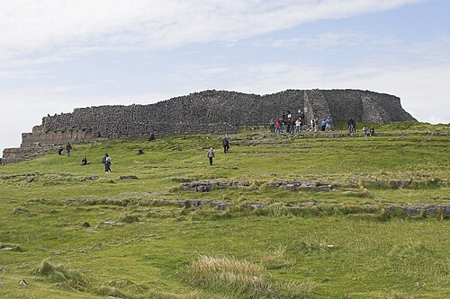 Dún AonghasaNature reserve · 16 yd
 DunaengusCliff-edge fort · 19 yd
 Not locatedStructure · 43 yd
 Kilmurvey BeachBeach / strand · 305 yd
 TemplenaneeveChurch · 928 yd
 IndicatedChurch · 1370 yd
 ÁrainnIsland · 1.6 mi
 Castle (in ruins)Castle, unclassified · 1.6 mi
 An CharcairMountain / peak · 2.0 mi
 Seal Colony LookoutViewpoint · 2.4 mi
 An tOileán ThiarIslet · 3.5 mi
 Trá na mBuailte (Beach of the Booly)Beach / strand · 4.0 mi