What is recorded here
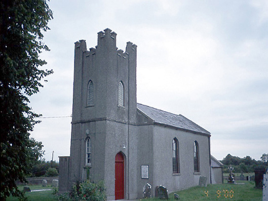
Situated on the crest of an E-W ridge. The parish church of Greenoge (ME045-018----) is within a subrectangular graveyard (dims c. 55m N-S; c. 30m E-W at N to c. 45m E-W at S) defined by masonry walls, with headstones dating largely to the 19th and 20th centuries, although there is a headstone with the date 1753 in the nave of the church where the watch-house (ME045-018001-) occupies the NE corner of the nave and blocks half the chancel arch. The rectangular base of a cross (ME045--018003-) (dims 0.85-0.88m x 0.7m; H 0.24-0.27m) with a socket (dims 0.28m x 0.22m; D 0.2m) is on top of a gate-pier at the original entrance of the graveyard at the NW angle (Feeley 2001, 37). A holy well (ME045-062----) is at the roadside c. 90m to the NE. Archaeological monitoring (E004021) by R. Meenan of the repair of a section of the graveyard wall at E in 2009 produced no archaeological material (excavations.ie 2009:647).
Compiled by: Michael Moore
Date of upload: 8 April, 2015
Amended: 10 February 2021
The monument record does not grant public access. Check the route and ask the landowner before entering private land.
- What survives
- Recorded monument
Places near here
 Church (in Ruins)Church · 12 yd
 Enclosure in BallaghawearyEnclosure · 614 yd
 Enclosure in Rath (ratoath By., Greenoge Par.)Enclosure · 1042 yd
 CastleCastle, motte · 1.1 mi
 Wooly Ward's FarmHeritage attraction · 1.3 mi
 Saint David's Church (Kilsallaghan)church/chapel · 1.5 mi
 AshbourneMemorial · 1.6 mi
 Graveyard in KillosseryGraveyard · 1.8 mi
 Freedagh MoatCastle, motte · 2.3 mi
 Wesley's WoodsWood · 3.6 mi
 St. John's WellSpring · 4.0 mi
 St Cronans WellSpring · 4.6 mi