What is recorded here
To the E of and outside the medieval town of Athy (KD035-022----). Formerly a rectangular area (est. c. 60m N-S; c. 40m E-W) surrounding St. Michael’s parish church (KD035-022014-), but extended significantly to W and N in modern times. The earliest legible gravemarkers date from the 18th-century.
Compiled by: Gearóid Conroy
Date of upload: 11 December 2013
The monument record does not grant public access. Check the route and ask the landowner before entering private land.
- What survives
- Recorded monument
Places near here
 St Michaels Church (in Ruins)Church · 10 yd
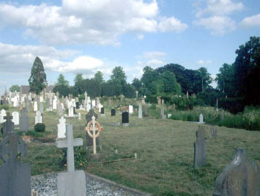 Saint Michael's Old Cemeterygraveyard/cemetery · 19 yd
 Athy War MemorialMemorial · 57 yd
 Zoltan Zinn-Collis memorialMemorial · 330 yd
 Town HallMuseum · 586 yd
 Whites [sic] Castle, Police BarrackCastle, tower house · 659 yd
 Enclosure in PrusselstownEnclosure · 1054 yd
 Woodstock CastleRuins · 1092 yd
 Enclosure in ArdrewEnclosure · 1308 yd
 Scots PineScots Pine · 1.7 mi
 Inch WoodForest · 3.0 mi
 History of Moat of ArdscullVisitor information · 3.3 mi